You are here: Home > Network List > TA - USArray Transportable Network (new EarthScope stations) Stations List
> Station G05D Wamic, OR, USA > Earthquake Result Viewer
G05D Wamic, OR, USA - Earthquake Result Viewer
*The percent match for this event was below the threshold and hence no stack was calculated.
| Earthquake location: |
Near East Coast Of Honshu, Japan |
| Earthquake latitude/longitude: |
39.1/142.9 |
| Earthquake time(UTC): |
2011/04/23 (113) 10:12:46 GMT |
| Earthquake Depth: |
31 km |
| Earthquake Magnitude: |
5.8 MB, 5.6 MS, 6.0 MW, 5.9 MW |
| Earthquake Catalog/Contributor: |
WHDF/NEIC |
|
| Network: |
TA USArray Transportable Network (new EarthScope stations) |
| Station: |
G05D Wamic, OR, USA |
| Lat/Lon: |
45.24 N/121.32 W |
| Elevation: |
592 m |
|
| Distance: |
67.1 deg |
| Az: |
49.72 deg |
| Baz: |
302.832 deg |
| Ray Param: |
$rayparam |
*The percent match for this event was below the threshold and hence was not used in the summary stack. |
|
| Radial Match: |
60.342663 % |
| Radial Bump: |
400 |
| Transverse Match: |
60.148968 % |
| Transverse Bump: |
359 |
| SOD ConfigId: |
356183 |
| Insert Time: |
2011-10-01 05:41:34.005 +0000 |
| GWidth: |
2.5 |
| Max Bumps: |
400 |
| Tol: |
0.001 |
|
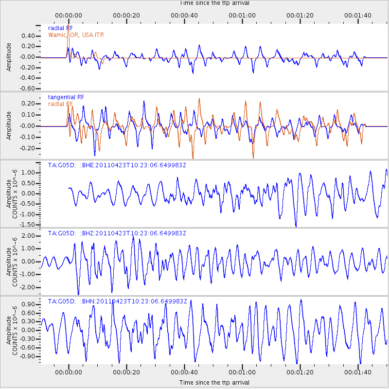
Signal To Noise
| Channel | StoN | STA | LTA |
| TA:G05D: :BHZ:20110423T10:23:06.649983Z | 3.9554927 | 1.044772E-6 | 2.6413196E-7 |
| TA:G05D: :BHN:20110423T10:23:06.649983Z | 0.6612396 | 3.7231806E-7 | 5.630607E-7 |
| TA:G05D: :BHE:20110423T10:23:06.649983Z | 1.3652941 | 3.9828524E-7 | 2.917212E-7 |
| Arrivals |
| Ps | |
| PpPs | |
| PsPs/PpSs | |


