You are here: Home > Network List > TA - USArray Transportable Network (new EarthScope stations) Stations List
> Station 534A Blanco, TX, USA > Earthquake Result Viewer
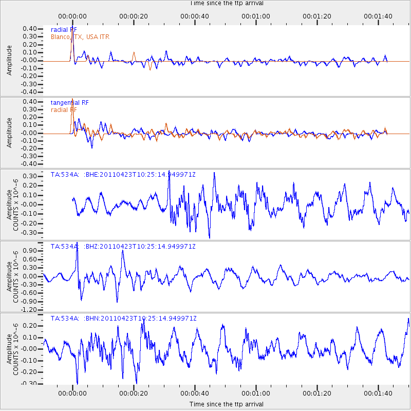
534A Blanco, TX, USA - Earthquake Result Viewer
*The percent match for this event was below the threshold and hence no stack was calculated.
| Earthquake location: |
Near East Coast Of Honshu, Japan |
| Earthquake latitude/longitude: |
39.1/142.9 |
| Earthquake time(UTC): |
2011/04/23 (113) 10:12:46 GMT |
| Earthquake Depth: |
31 km |
| Earthquake Magnitude: |
5.8 MB, 5.6 MS, 6.0 MW, 5.9 MW |
| Earthquake Catalog/Contributor: |
WHDF/NEIC |
|
| Network: |
TA USArray Transportable Network (new EarthScope stations) |
| Station: |
534A Blanco, TX, USA |
| Lat/Lon: |
30.03 N/98.48 W |
| Elevation: |
461 m |
|
| Distance: |
90.6 deg |
| Az: |
49.558 deg |
| Baz: |
316.931 deg |
| Ray Param: |
$rayparam |
*The percent match for this event was below the threshold and hence was not used in the summary stack. |
|
| Radial Match: |
71.03458 % |
| Radial Bump: |
400 |
| Transverse Match: |
82.61465 % |
| Transverse Bump: |
396 |
| SOD ConfigId: |
356183 |
| Insert Time: |
2011-10-01 05:47:53.128 +0000 |
| GWidth: |
2.5 |
| Max Bumps: |
400 |
| Tol: |
0.001 |
|
Signal To Noise
| Channel | StoN | STA | LTA |
| TA:534A: :BHZ:20110423T10:25:14.949971Z | 4.4677987 | 4.5003486E-7 | 1.0072854E-7 |
| TA:534A: :BHN:20110423T10:25:14.949971Z | 2.2449567 | 1.08478886E-7 | 4.8321148E-8 |
| TA:534A: :BHE:20110423T10:25:14.949971Z | 2.457565 | 1.324109E-7 | 5.38789E-8 |
| Arrivals |
| Ps | |
| PpPs | |
| PsPs/PpSs | |


