H31A Wolsey, SD, USA - Earthquake Result Viewer
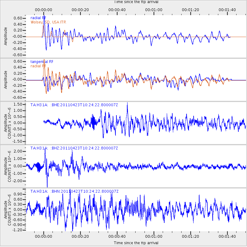
Earthquake location: Near East Coast Of Honshu, Japan
Earthquake latitude/longitude: 39.1/142.9
Earthquake time(UTC): 2011/04/23 (113) 10:12:46 GMT
Earthquake Depth: 31 km
Earthquake Magnitude: 5.8 MB, 5.6 MS, 6.0 MW, 5.9 MW
Earthquake Catalog/Contributor: WHDF/NEIC
Network: TA USArray Transportable Network (new EarthScope stations)
Station: H31A Wolsey, SD, USA
Lat/Lon: 44.48 N/98.48 W
Elevation: 415 m
Distance: 80.1 deg
Az: 39.615 deg
Baz: 316.122 deg
Ray Param: 0.048448212
Estimated Moho Depth: 15.5 km
Estimated Crust Vp/Vs: 2.10
Assumed Crust Vp: 6.53 km/s
Estimated Crust Vs: 3.113 km/s
Estimated Crust Poisson's Ratio: 0.35
Radial Match: 85.552734 %
Radial Bump: 400
Transverse Match: 73.6228 %
Transverse Bump: 400
SOD ConfigId: 356183
Insert Time: 2011-10-01 06:27:46.329 +0000
GWidth: 2.5
Max Bumps: 400
Tol: 0.001

Signal To Noise

ChannelStoNSTALTA
TA:H31A: :BHZ:20110423T10:24:22.800007Z4.97045669.193261E-71.8495808E-7
TA:H31A: :BHN:20110423T10:24:22.800007Z1.55118273.8530115E-72.4839184E-7
TA:H31A: :BHE:20110423T10:24:22.800007Z3.23368225.841557E-71.8064723E-7
Arrivals
Ps2.7 SECOND
PpPs7.2 SECOND
PsPs/PpSs9.8 SECOND