You are here: Home > Network List > TA - USArray Transportable Network (new EarthScope stations) Stations List
> Station D33A AnnSam, Waubun, MN, USA > Earthquake Result Viewer
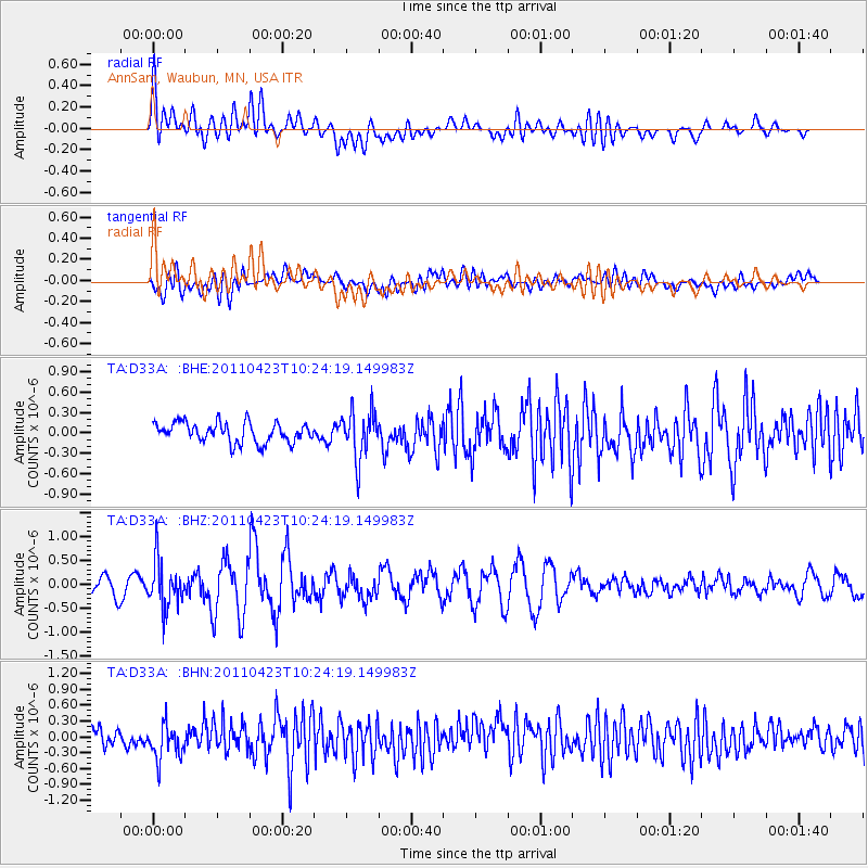
D33A AnnSam, Waubun, MN, USA - Earthquake Result Viewer
*The percent match for this event was below the threshold and hence no stack was calculated.
| Earthquake location: |
Near East Coast Of Honshu, Japan |
| Earthquake latitude/longitude: |
39.1/142.9 |
| Earthquake time(UTC): |
2011/04/23 (113) 10:12:46 GMT |
| Earthquake Depth: |
31 km |
| Earthquake Magnitude: |
5.8 MB, 5.6 MS, 6.0 MW, 5.9 MW |
| Earthquake Catalog/Contributor: |
WHDF/NEIC |
|
| Network: |
TA USArray Transportable Network (new EarthScope stations) |
| Station: |
D33A AnnSam, Waubun, MN, USA |
| Lat/Lon: |
47.14 N/95.84 W |
| Elevation: |
466 m |
|
| Distance: |
79.4 deg |
| Az: |
36.401 deg |
| Baz: |
317.434 deg |
| Ray Param: |
$rayparam |
*The percent match for this event was below the threshold and hence was not used in the summary stack. |
|
| Radial Match: |
64.73645 % |
| Radial Bump: |
400 |
| Transverse Match: |
60.259777 % |
| Transverse Bump: |
400 |
| SOD ConfigId: |
356183 |
| Insert Time: |
2011-10-01 06:31:09.843 +0000 |
| GWidth: |
2.5 |
| Max Bumps: |
400 |
| Tol: |
0.001 |
|
Signal To Noise
| Channel | StoN | STA | LTA |
| TA:D33A: :BHZ:20110423T10:24:19.149983Z | 2.578905 | 4.8180334E-7 | 1.8682476E-7 |
| TA:D33A: :BHN:20110423T10:24:19.149983Z | 1.9515399 | 3.3168135E-7 | 1.6995878E-7 |
| TA:D33A: :BHE:20110423T10:24:19.149983Z | 2.4387543 | 3.556249E-7 | 1.4582236E-7 |
| Arrivals |
| Ps | |
| PpPs | |
| PsPs/PpSs | |


