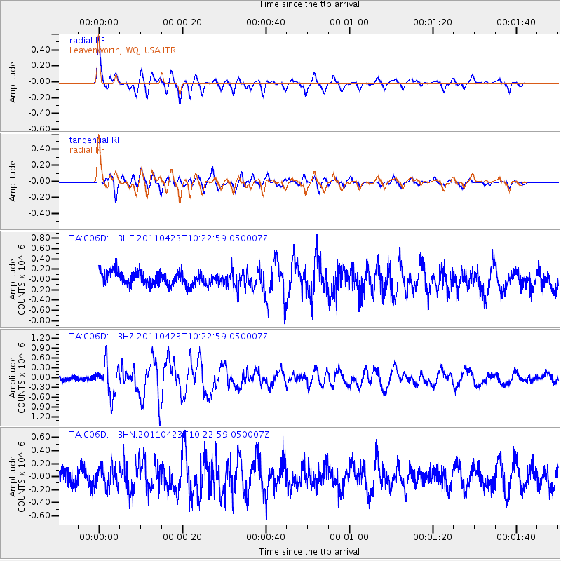
C06D Leavenworth, WQ, USA - Earthquake Result Viewer
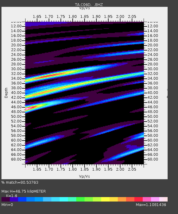
Earthquake location: Near East Coast Of Honshu, Japan
Earthquake latitude/longitude: 39.1/142.9
Earthquake time(UTC): 2011/04/23 (113) 10:12:46 GMT
Earthquake Depth: 31 km
Earthquake Magnitude: 5.8 MB, 5.6 MS, 6.0 MW, 5.9 MW
Earthquake Catalog/Contributor: WHDF/NEIC
Network: TA USArray Transportable Network (new EarthScope stations)
Station: C06D Leavenworth, WQ, USA
Lat/Lon: 47.92 N/120.89 W
Elevation: 544 m
Distance: 65.9 deg
Az: 47.082 deg
Baz: 302.087 deg
Ray Param: 0.057904344
Estimated Moho Depth: 46.75 km
Estimated Crust Vp/Vs: 1.60
Assumed Crust Vp: 6.597 km/s
Estimated Crust Vs: 4.123 km/s
Estimated Crust Poisson's Ratio: 0.18
Radial Match: 80.53763 %
Radial Bump: 400
Transverse Match: 83.108765 %
Transverse Bump: 400
SOD ConfigId: 356183
Insert Time: 2011-10-01 06:31:50.055 +0000
GWidth: 2.5
Max Bumps: 400
Tol: 0.001

Signal To Noise

ChannelStoNSTALTA
TA:C06D: :BHZ:20110423T10:22:59.050007Z4.46840764.6069817E-71.031012E-7
TA:C06D: :BHN:20110423T10:22:59.050007Z1.8253261.5628368E-78.56196E-8
TA:C06D: :BHE:20110423T10:22:59.050007Z1.32599091.6489966E-71.2435956E-7
Arrivals
Ps4.5 SECOND
PpPs18 SECOND
PsPs/PpSs22 SECOND