You are here: Home > Network List > TA - USArray Transportable Network (new EarthScope stations) Stations List
> Station A33A Warroad, MN, USA > Earthquake Result Viewer
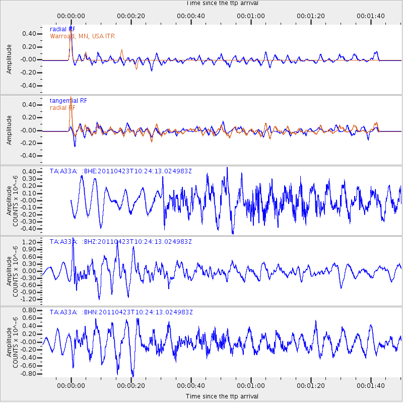
A33A Warroad, MN, USA - Earthquake Result Viewer
*The percent match for this event was below the threshold and hence no stack was calculated.
| Earthquake location: |
Near East Coast Of Honshu, Japan |
| Earthquake latitude/longitude: |
39.1/142.9 |
| Earthquake time(UTC): |
2011/04/23 (113) 10:12:46 GMT |
| Earthquake Depth: |
31 km |
| Earthquake Magnitude: |
5.8 MB, 5.6 MS, 6.0 MW, 5.9 MW |
| Earthquake Catalog/Contributor: |
WHDF/NEIC |
|
| Network: |
TA USArray Transportable Network (new EarthScope stations) |
| Station: |
A33A Warroad, MN, USA |
| Lat/Lon: |
48.94 N/95.39 W |
| Elevation: |
329 m |
|
| Distance: |
78.3 deg |
| Az: |
34.933 deg |
| Baz: |
317.488 deg |
| Ray Param: |
$rayparam |
*The percent match for this event was below the threshold and hence was not used in the summary stack. |
|
| Radial Match: |
70.32955 % |
| Radial Bump: |
357 |
| Transverse Match: |
71.64425 % |
| Transverse Bump: |
383 |
| SOD ConfigId: |
356183 |
| Insert Time: |
2011-10-01 06:37:40.999 +0000 |
| GWidth: |
2.5 |
| Max Bumps: |
400 |
| Tol: |
0.001 |
|
Signal To Noise
| Channel | StoN | STA | LTA |
| TA:A33A: :BHZ:20110423T10:24:13.024983Z | 2.118456 | 4.540433E-7 | 2.1432747E-7 |
| TA:A33A: :BHN:20110423T10:24:13.024983Z | 1.6979344 | 2.2970285E-7 | 1.352837E-7 |
| TA:A33A: :BHE:20110423T10:24:13.024983Z | 0.90521073 | 1.4369614E-7 | 1.587433E-7 |
| Arrivals |
| Ps | |
| PpPs | |
| PsPs/PpSs | |


