You are here: Home > Network List > TA - USArray Transportable Network (new EarthScope stations) Stations List
> Station K37A Belmond, IA, USA > Earthquake Result Viewer
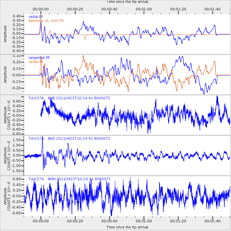
K37A Belmond, IA, USA - Earthquake Result Viewer
*The percent match for this event was below the threshold and hence no stack was calculated.
| Earthquake location: |
Near East Coast Of Honshu, Japan |
| Earthquake latitude/longitude: |
39.1/142.9 |
| Earthquake time(UTC): |
2011/04/23 (113) 10:12:46 GMT |
| Earthquake Depth: |
31 km |
| Earthquake Magnitude: |
5.8 MB, 5.6 MS, 6.0 MW, 5.9 MW |
| Earthquake Catalog/Contributor: |
WHDF/NEIC |
|
| Network: |
TA USArray Transportable Network (new EarthScope stations) |
| Station: |
K37A Belmond, IA, USA |
| Lat/Lon: |
42.77 N/93.64 W |
| Elevation: |
365 m |
|
| Distance: |
83.8 deg |
| Az: |
38.155 deg |
| Baz: |
319.245 deg |
| Ray Param: |
$rayparam |
*The percent match for this event was below the threshold and hence was not used in the summary stack. |
|
| Radial Match: |
50.56243 % |
| Radial Bump: |
400 |
| Transverse Match: |
62.235336 % |
| Transverse Bump: |
400 |
| SOD ConfigId: |
356183 |
| Insert Time: |
2011-10-01 06:41:01.294 +0000 |
| GWidth: |
2.5 |
| Max Bumps: |
400 |
| Tol: |
0.001 |
|
Signal To Noise
| Channel | StoN | STA | LTA |
| TA:K37A: :BHZ:20110423T10:24:41.800007Z | 4.47424 | 6.4930276E-7 | 1.4512024E-7 |
| TA:K37A: :BHN:20110423T10:24:41.800007Z | 1.0457835 | 2.044785E-7 | 1.9552661E-7 |
| TA:K37A: :BHE:20110423T10:24:41.800007Z | 0.756136 | 2.0060568E-7 | 2.653037E-7 |
| Arrivals |
| Ps | |
| PpPs | |
| PsPs/PpSs | |


