P38A Dawn, MO, USA - Earthquake Result Viewer
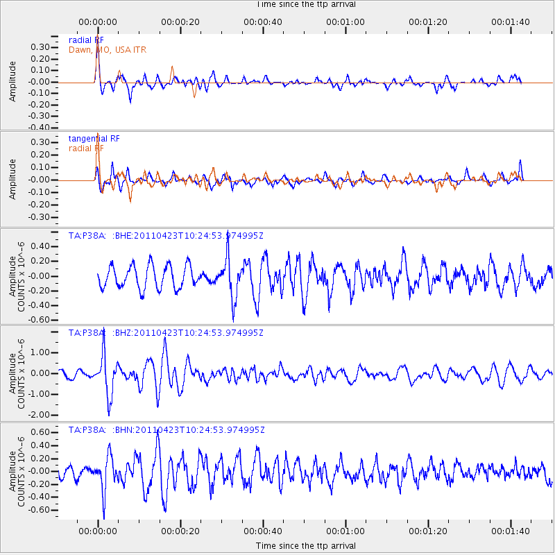
Earthquake location: Near East Coast Of Honshu, Japan
Earthquake latitude/longitude: 39.1/142.9
Earthquake time(UTC): 2011/04/23 (113) 10:12:46 GMT
Earthquake Depth: 31 km
Earthquake Magnitude: 5.8 MB, 5.6 MS, 6.0 MW, 5.9 MW
Earthquake Catalog/Contributor: WHDF/NEIC
Network: TA USArray Transportable Network (new EarthScope stations)
Station: P38A Dawn, MO, USA
Lat/Lon: 39.62 N/93.53 W
Elevation: 248 m
Distance: 86.2 deg
Az: 40.146 deg
Baz: 319.49 deg
Ray Param: 0.04418787
Estimated Moho Depth: 12.75 km
Estimated Crust Vp/Vs: 2.09
Assumed Crust Vp: 6.498 km/s
Estimated Crust Vs: 3.109 km/s
Estimated Crust Poisson's Ratio: 0.35
Radial Match: 82.09839 %
Radial Bump: 400
Transverse Match: 62.164783 %
Transverse Bump: 375
SOD ConfigId: 356183
Insert Time: 2011-10-01 06:49:12.200 +0000
GWidth: 2.5
Max Bumps: 400
Tol: 0.001

Signal To Noise

ChannelStoNSTALTA
TA:P38A: :BHZ:20110423T10:24:53.974995Z4.4003059.663215E-72.1960332E-7
TA:P38A: :BHN:20110423T10:24:53.974995Z1.32790032.6873204E-72.0237364E-7
TA:P38A: :BHE:20110423T10:24:53.974995Z1.7798582.6888878E-71.5107317E-7
Arrivals
Ps2.2 SECOND
PpPs5.9 SECOND
PsPs/PpSs8.1 SECOND