You are here: Home > Network List > US - United States National Seismic Network Stations List
> Station DGMT Dagmar, Montana, USA > Earthquake Result Viewer
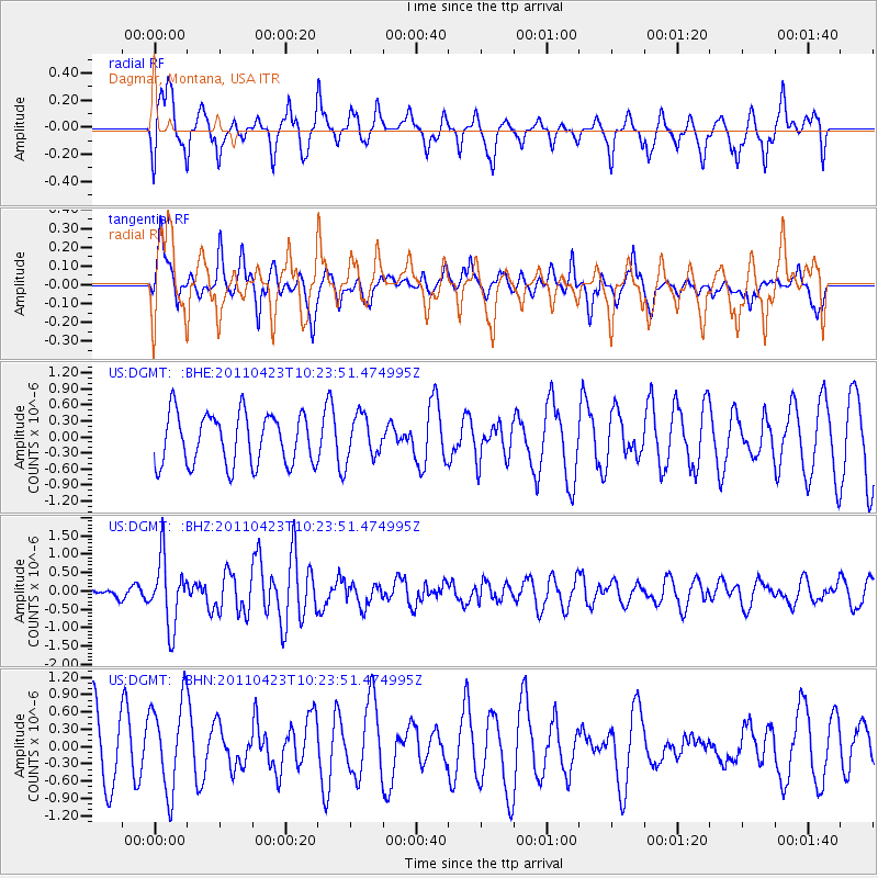
DGMT Dagmar, Montana, USA - Earthquake Result Viewer
*The percent match for this event was below the threshold and hence no stack was calculated.
| Earthquake location: |
Near East Coast Of Honshu, Japan |
| Earthquake latitude/longitude: |
39.1/142.9 |
| Earthquake time(UTC): |
2011/04/23 (113) 10:12:46 GMT |
| Earthquake Depth: |
31 km |
| Earthquake Magnitude: |
5.8 MB, 5.6 MS, 6.0 MW, 5.9 MW |
| Earthquake Catalog/Contributor: |
WHDF/NEIC |
|
| Network: |
US United States National Seismic Network |
| Station: |
DGMT Dagmar, Montana, USA |
| Lat/Lon: |
48.47 N/104.20 W |
| Elevation: |
0.0 m |
|
| Distance: |
74.5 deg |
| Az: |
39.493 deg |
| Baz: |
311.959 deg |
| Ray Param: |
$rayparam |
*The percent match for this event was below the threshold and hence was not used in the summary stack. |
|
| Radial Match: |
48.43698 % |
| Radial Bump: |
398 |
| Transverse Match: |
60.38773 % |
| Transverse Bump: |
400 |
| SOD ConfigId: |
356183 |
| Insert Time: |
2011-10-01 07:13:34.485 +0000 |
| GWidth: |
2.5 |
| Max Bumps: |
400 |
| Tol: |
0.001 |
|
Signal To Noise
| Channel | StoN | STA | LTA |
| US:DGMT: :BHZ:20110423T10:23:51.474995Z | 4.770389 | 9.042183E-7 | 1.8954812E-7 |
| US:DGMT: :BHN:20110423T10:23:51.474995Z | 1.1328905 | 7.727303E-7 | 6.820874E-7 |
| US:DGMT: :BHE:20110423T10:23:51.474995Z | 0.8476617 | 4.0427003E-7 | 4.769238E-7 |
| Arrivals |
| Ps | |
| PpPs | |
| PsPs/PpSs | |


