You are here: Home > Network List > US - United States National Seismic Network Stations List
> Station EGMT Eagleton, Montana, USA > Earthquake Result Viewer
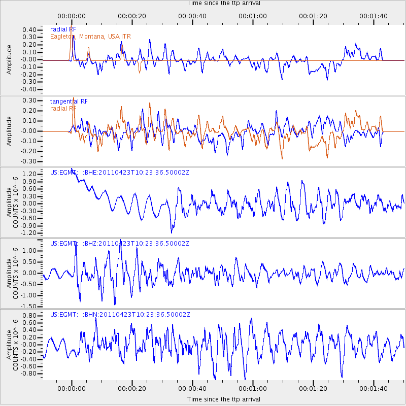
EGMT Eagleton, Montana, USA - Earthquake Result Viewer
*The percent match for this event was below the threshold and hence no stack was calculated.
| Earthquake location: |
Near East Coast Of Honshu, Japan |
| Earthquake latitude/longitude: |
39.1/142.9 |
| Earthquake time(UTC): |
2011/04/23 (113) 10:12:46 GMT |
| Earthquake Depth: |
31 km |
| Earthquake Magnitude: |
5.8 MB, 5.6 MS, 6.0 MW, 5.9 MW |
| Earthquake Catalog/Contributor: |
WHDF/NEIC |
|
| Network: |
US United States National Seismic Network |
| Station: |
EGMT Eagleton, Montana, USA |
| Lat/Lon: |
48.02 N/109.75 W |
| Elevation: |
1055 m |
|
| Distance: |
72.0 deg |
| Az: |
42.358 deg |
| Baz: |
308.648 deg |
| Ray Param: |
$rayparam |
*The percent match for this event was below the threshold and hence was not used in the summary stack. |
|
| Radial Match: |
35.462708 % |
| Radial Bump: |
391 |
| Transverse Match: |
43.784687 % |
| Transverse Bump: |
400 |
| SOD ConfigId: |
356183 |
| Insert Time: |
2011-10-01 07:14:54.544 +0000 |
| GWidth: |
2.5 |
| Max Bumps: |
400 |
| Tol: |
0.001 |
|
Signal To Noise
| Channel | StoN | STA | LTA |
| US:EGMT: :BHZ:20110423T10:23:36.50002Z | 4.0552206 | 5.6637526E-7 | 1.3966572E-7 |
| US:EGMT: :BHN:20110423T10:23:36.50002Z | 1.1070135 | 2.1877746E-7 | 1.9762854E-7 |
| US:EGMT: :BHE:20110423T10:23:36.50002Z | 1.4982004 | 7.4013167E-7 | 4.9401376E-7 |
| Arrivals |
| Ps | |
| PpPs | |
| PsPs/PpSs | |


