You are here: Home > Network List > UW - Pacific Northwest Regional Seismic Network Stations List
> Station LEBA Lebam, WA, USA > Earthquake Result Viewer
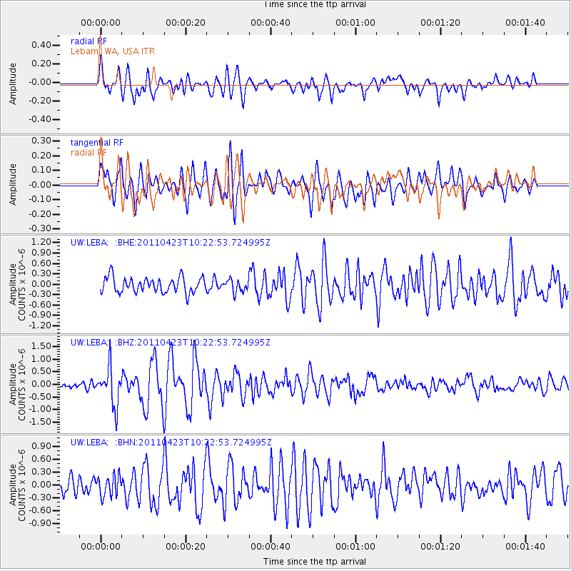
LEBA Lebam, WA, USA - Earthquake Result Viewer
*The percent match for this event was below the threshold and hence no stack was calculated.
| Earthquake location: |
Near East Coast Of Honshu, Japan |
| Earthquake latitude/longitude: |
39.1/142.9 |
| Earthquake time(UTC): |
2011/04/23 (113) 10:12:46 GMT |
| Earthquake Depth: |
31 km |
| Earthquake Magnitude: |
5.8 MB, 5.6 MS, 6.0 MW, 5.9 MW |
| Earthquake Catalog/Contributor: |
WHDF/NEIC |
|
| Network: |
UW Pacific Northwest Regional Seismic Network |
| Station: |
LEBA Lebam, WA, USA |
| Lat/Lon: |
46.55 N/123.56 W |
| Elevation: |
73 m |
|
| Distance: |
65.1 deg |
| Az: |
49.418 deg |
| Baz: |
301.102 deg |
| Ray Param: |
$rayparam |
*The percent match for this event was below the threshold and hence was not used in the summary stack. |
|
| Radial Match: |
73.364235 % |
| Radial Bump: |
400 |
| Transverse Match: |
76.93339 % |
| Transverse Bump: |
400 |
| SOD ConfigId: |
356183 |
| Insert Time: |
2011-10-01 07:23:23.891 +0000 |
| GWidth: |
2.5 |
| Max Bumps: |
400 |
| Tol: |
0.001 |
|
Signal To Noise
| Channel | StoN | STA | LTA |
| UW:LEBA: :BHZ:20110423T10:22:53.724995Z | 6.35694 | 7.71107E-7 | 1.2130161E-7 |
| UW:LEBA: :BHN:20110423T10:22:53.724995Z | 1.2052344 | 2.3422719E-7 | 1.943416E-7 |
| UW:LEBA: :BHE:20110423T10:22:53.724995Z | 0.83559936 | 1.8235228E-7 | 2.1822932E-7 |
| Arrivals |
| Ps | |
| PpPs | |
| PsPs/PpSs | |


