You are here: Home > Network List > CN - Canadian National Seismograph Network Stations List
> Station ULM LAC DU BONNET, MB, CANADA > Earthquake Result Viewer
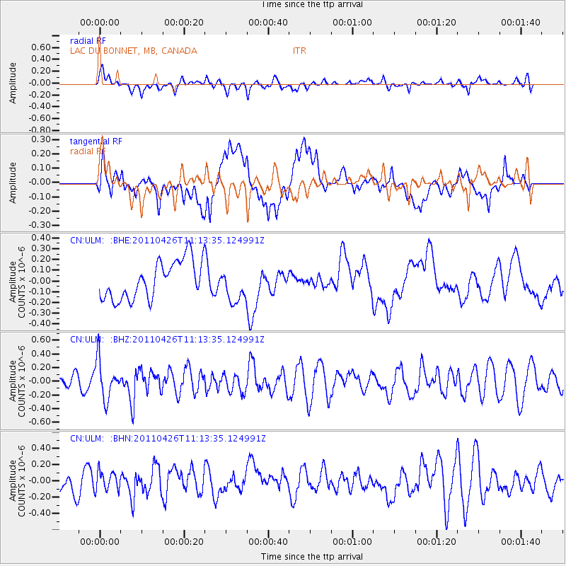
ULM LAC DU BONNET, MB, CANADA - Earthquake Result Viewer
*The percent match for this event was below the threshold and hence no stack was calculated.
| Earthquake location: |
Near Coast Of Guerrero, Mexico |
| Earthquake latitude/longitude: |
16.9/-99.5 |
| Earthquake time(UTC): |
2011/04/26 (116) 11:07:27 GMT |
| Earthquake Depth: |
11 km |
| Earthquake Magnitude: |
5.5 MW, 4.9 MS, 5.3 MB, 5.4 MW |
| Earthquake Catalog/Contributor: |
WHDF/NEIC |
|
| Network: |
CN Canadian National Seismograph Network |
| Station: |
ULM LAC DU BONNET, MB, CANADA |
| Lat/Lon: |
50.25 N/95.87 W |
| Elevation: |
251 m |
|
| Distance: |
33.4 deg |
| Az: |
4.19 deg |
| Baz: |
186.257 deg |
| Ray Param: |
$rayparam |
*The percent match for this event was below the threshold and hence was not used in the summary stack. |
|
| Radial Match: |
52.082573 % |
| Radial Bump: |
400 |
| Transverse Match: |
42.939117 % |
| Transverse Bump: |
400 |
| SOD ConfigId: |
356183 |
| Insert Time: |
2011-10-01 08:28:52.555 +0000 |
| GWidth: |
2.5 |
| Max Bumps: |
400 |
| Tol: |
0.001 |
|
Signal To Noise
| Channel | StoN | STA | LTA |
| CN:ULM: :BHZ:20110426T11:13:35.124991Z | 2.6674364 | 2.8716508E-7 | 1.07655836E-7 |
| CN:ULM: :BHN:20110426T11:13:35.124991Z | 1.0661751 | 1.1552279E-7 | 1.08352545E-7 |
| CN:ULM: :BHE:20110426T11:13:35.124991Z | 0.9136606 | 1.6251255E-7 | 1.7786972E-7 |
| Arrivals |
| Ps | |
| PpPs | |
| PsPs/PpSs | |


