You are here: Home > Network List > TA - USArray Transportable Network (new EarthScope stations) Stations List
> Station A27A Ledoux Ranch, Antler, ND, USA > Earthquake Result Viewer
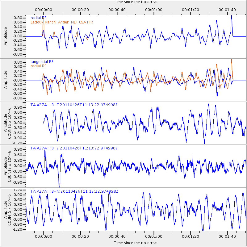
A27A Ledoux Ranch, Antler, ND, USA - Earthquake Result Viewer
*The percent match for this event was below the threshold and hence no stack was calculated.
| Earthquake location: |
Near Coast Of Guerrero, Mexico |
| Earthquake latitude/longitude: |
16.9/-99.5 |
| Earthquake time(UTC): |
2011/04/26 (116) 11:07:27 GMT |
| Earthquake Depth: |
11 km |
| Earthquake Magnitude: |
5.5 MW, 4.9 MS, 5.3 MB, 5.4 MW |
| Earthquake Catalog/Contributor: |
WHDF/NEIC |
|
| Network: |
TA USArray Transportable Network (new EarthScope stations) |
| Station: |
A27A Ledoux Ranch, Antler, ND, USA |
| Lat/Lon: |
48.95 N/101.24 W |
| Elevation: |
466 m |
|
| Distance: |
32.1 deg |
| Az: |
357.802 deg |
| Baz: |
176.805 deg |
| Ray Param: |
$rayparam |
*The percent match for this event was below the threshold and hence was not used in the summary stack. |
|
| Radial Match: |
48.13583 % |
| Radial Bump: |
400 |
| Transverse Match: |
62.71238 % |
| Transverse Bump: |
400 |
| SOD ConfigId: |
356183 |
| Insert Time: |
2011-10-01 08:43:56.958 +0000 |
| GWidth: |
2.5 |
| Max Bumps: |
400 |
| Tol: |
0.001 |
|
Signal To Noise
| Channel | StoN | STA | LTA |
| TA:A27A: :BHZ:20110426T11:13:22.974998Z | 2.3238618 | 3.1417125E-7 | 1.351936E-7 |
| TA:A27A: :BHN:20110426T11:13:22.974998Z | 0.79070574 | 5.966528E-7 | 7.5458263E-7 |
| TA:A27A: :BHE:20110426T11:13:22.974998Z | 0.7664555 | 3.264883E-7 | 4.2597165E-7 |
| Arrivals |
| Ps | |
| PpPs | |
| PsPs/PpSs | |


