You are here: Home > Network List > US - United States National Seismic Network Stations List
> Station NEW Newport, Washington, USA > Earthquake Result Viewer
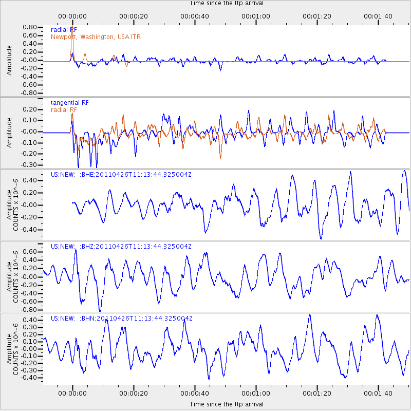
NEW Newport, Washington, USA - Earthquake Result Viewer
*The percent match for this event was below the threshold and hence no stack was calculated.
| Earthquake location: |
Near Coast Of Guerrero, Mexico |
| Earthquake latitude/longitude: |
16.9/-99.5 |
| Earthquake time(UTC): |
2011/04/26 (116) 11:07:27 GMT |
| Earthquake Depth: |
11 km |
| Earthquake Magnitude: |
5.5 MW, 4.9 MS, 5.3 MB, 5.4 MW |
| Earthquake Catalog/Contributor: |
WHDF/NEIC |
|
| Network: |
US United States National Seismic Network |
| Station: |
NEW Newport, Washington, USA |
| Lat/Lon: |
48.26 N/117.12 W |
| Elevation: |
760 m |
|
| Distance: |
34.5 deg |
| Az: |
339.045 deg |
| Baz: |
149.167 deg |
| Ray Param: |
$rayparam |
*The percent match for this event was below the threshold and hence was not used in the summary stack. |
|
| Radial Match: |
64.01492 % |
| Radial Bump: |
392 |
| Transverse Match: |
81.68782 % |
| Transverse Bump: |
400 |
| SOD ConfigId: |
356183 |
| Insert Time: |
2011-10-01 08:54:31.011 +0000 |
| GWidth: |
2.5 |
| Max Bumps: |
400 |
| Tol: |
0.001 |
|
Signal To Noise
| Channel | StoN | STA | LTA |
| US:NEW: :BHZ:20110426T11:13:44.325004Z | 2.6806123 | 3.956288E-7 | 1.4758898E-7 |
| US:NEW: :BHN:20110426T11:13:44.325004Z | 1.5068572 | 1.7919066E-7 | 1.1891682E-7 |
| US:NEW: :BHE:20110426T11:13:44.325004Z | 1.0162671 | 1.2037542E-7 | 1.1844861E-7 |
| Arrivals |
| Ps | |
| PpPs | |
| PsPs/PpSs | |


