You are here: Home > Network List > US - United States National Seismic Network Stations List
> Station EYMN Ely, Minnesota, USA > Earthquake Result Viewer
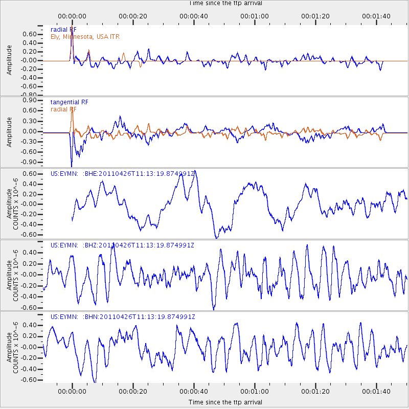
EYMN Ely, Minnesota, USA - Earthquake Result Viewer
*The percent match for this event was below the threshold and hence no stack was calculated.
| Earthquake location: |
Near Coast Of Guerrero, Mexico |
| Earthquake latitude/longitude: |
16.9/-99.5 |
| Earthquake time(UTC): |
2011/04/26 (116) 11:07:27 GMT |
| Earthquake Depth: |
11 km |
| Earthquake Magnitude: |
5.5 MW, 4.9 MS, 5.3 MB, 5.4 MW |
| Earthquake Catalog/Contributor: |
WHDF/NEIC |
|
| Network: |
US United States National Seismic Network |
| Station: |
EYMN Ely, Minnesota, USA |
| Lat/Lon: |
47.95 N/91.50 W |
| Elevation: |
475 m |
|
| Distance: |
31.7 deg |
| Az: |
10.227 deg |
| Baz: |
194.649 deg |
| Ray Param: |
$rayparam |
*The percent match for this event was below the threshold and hence was not used in the summary stack. |
|
| Radial Match: |
70.881454 % |
| Radial Bump: |
400 |
| Transverse Match: |
66.736885 % |
| Transverse Bump: |
400 |
| SOD ConfigId: |
356183 |
| Insert Time: |
2011-10-01 08:54:42.563 +0000 |
| GWidth: |
2.5 |
| Max Bumps: |
400 |
| Tol: |
0.001 |
|
Signal To Noise
| Channel | StoN | STA | LTA |
| US:EYMN: :BHZ:20110426T11:13:19.874991Z | 2.1838274 | 2.9195155E-7 | 1.33688E-7 |
| US:EYMN: :BHN:20110426T11:13:19.874991Z | 1.3777965 | 2.7211038E-7 | 1.9749677E-7 |
| US:EYMN: :BHE:20110426T11:13:19.874991Z | 0.7881385 | 1.9684931E-7 | 2.497649E-7 |
| Arrivals |
| Ps | |
| PpPs | |
| PsPs/PpSs | |


