You are here: Home > Network List > UW - Pacific Northwest Regional Seismic Network Stations List
> Station MRBL Marblemount, WA, USA > Earthquake Result Viewer
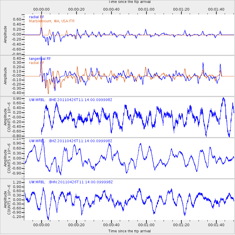
MRBL Marblemount, WA, USA - Earthquake Result Viewer
*The percent match for this event was below the threshold and hence no stack was calculated.
| Earthquake location: |
Near Coast Of Guerrero, Mexico |
| Earthquake latitude/longitude: |
16.9/-99.5 |
| Earthquake time(UTC): |
2011/04/26 (116) 11:07:27 GMT |
| Earthquake Depth: |
11 km |
| Earthquake Magnitude: |
5.5 MW, 4.9 MS, 5.3 MB, 5.4 MW |
| Earthquake Catalog/Contributor: |
WHDF/NEIC |
|
| Network: |
UW Pacific Northwest Regional Seismic Network |
| Station: |
MRBL Marblemount, WA, USA |
| Lat/Lon: |
48.52 N/121.48 W |
| Elevation: |
75 m |
|
| Distance: |
36.3 deg |
| Az: |
335.133 deg |
| Baz: |
142.724 deg |
| Ray Param: |
$rayparam |
*The percent match for this event was below the threshold and hence was not used in the summary stack. |
|
| Radial Match: |
63.152077 % |
| Radial Bump: |
400 |
| Transverse Match: |
67.87811 % |
| Transverse Bump: |
400 |
| SOD ConfigId: |
356183 |
| Insert Time: |
2011-10-01 08:58:22.297 +0000 |
| GWidth: |
2.5 |
| Max Bumps: |
400 |
| Tol: |
0.001 |
|
Signal To Noise
| Channel | StoN | STA | LTA |
| UW:MRBL: :BHZ:20110426T11:14:00.099998Z | 1.6137321 | 6.253974E-7 | 3.8754717E-7 |
| UW:MRBL: :BHN:20110426T11:14:00.099998Z | 2.5517275 | 7.3740244E-7 | 2.8898165E-7 |
| UW:MRBL: :BHE:20110426T11:14:00.099998Z | 0.7736268 | 2.0409689E-7 | 2.638183E-7 |
| Arrivals |
| Ps | |
| PpPs | |
| PsPs/PpSs | |


