You are here: Home > Network List > UW - Pacific Northwest Regional Seismic Network Stations List
> Station UMAT Pilot Rock, OR, USA > Earthquake Result Viewer
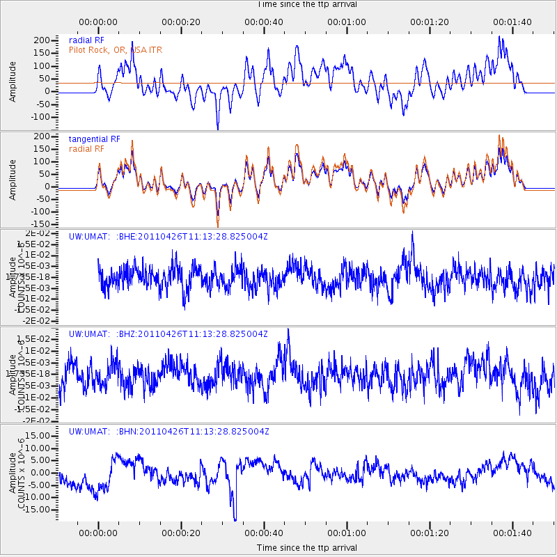
UMAT Pilot Rock, OR, USA - Earthquake Result Viewer
*The percent match for this event was below the threshold and hence no stack was calculated.
| Earthquake location: |
Near Coast Of Guerrero, Mexico |
| Earthquake latitude/longitude: |
16.9/-99.5 |
| Earthquake time(UTC): |
2011/04/26 (116) 11:07:27 GMT |
| Earthquake Depth: |
11 km |
| Earthquake Magnitude: |
5.5 MW, 4.9 MS, 5.3 MB, 5.4 MW |
| Earthquake Catalog/Contributor: |
WHDF/NEIC |
|
| Network: |
UW Pacific Northwest Regional Seismic Network |
| Station: |
UMAT Pilot Rock, OR, USA |
| Lat/Lon: |
45.29 N/118.96 W |
| Elevation: |
1318 m |
|
| Distance: |
32.7 deg |
| Az: |
334.173 deg |
| Baz: |
143.772 deg |
| Ray Param: |
$rayparam |
*The percent match for this event was below the threshold and hence was not used in the summary stack. |
|
| Radial Match: |
46.79977 % |
| Radial Bump: |
400 |
| Transverse Match: |
46.802624 % |
| Transverse Bump: |
400 |
| SOD ConfigId: |
356183 |
| Insert Time: |
2011-10-01 08:59:12.242 +0000 |
| GWidth: |
2.5 |
| Max Bumps: |
400 |
| Tol: |
0.001 |
|
Signal To Noise
| Channel | StoN | STA | LTA |
| UW:UMAT: :BHZ:20110426T11:13:28.825004Z | 0.96197784 | 4.610615E-9 | 4.7928492E-9 |
| UW:UMAT: :BHN:20110426T11:13:28.825004Z | 1.7411277 | 7.3517413E-6 | 4.222402E-6 |
| UW:UMAT: :BHE:20110426T11:13:28.825004Z | 0.94856244 | 4.4170996E-9 | 4.656625E-9 |
| Arrivals |
| Ps | |
| PpPs | |
| PsPs/PpSs | |


