You are here: Home > Network List > CI - Caltech Regional Seismic Network Stations List
> Station MPM Manuel Prospect Mine, California, USA > Earthquake Result Viewer
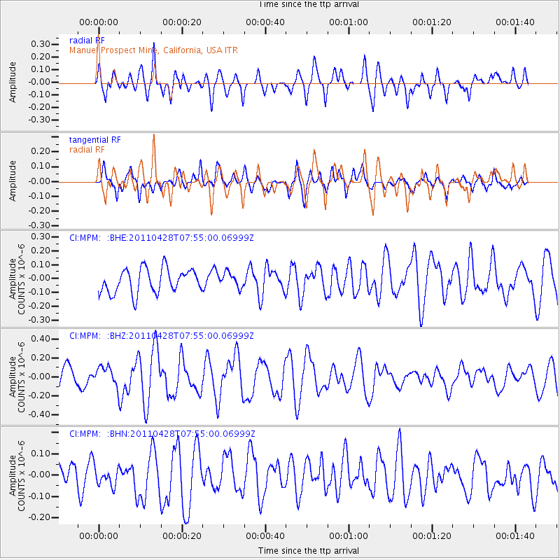
MPM Manuel Prospect Mine, California, USA - Earthquake Result Viewer
*The percent match for this event was below the threshold and hence no stack was calculated.
| Earthquake location: |
Solomon Islands |
| Earthquake latitude/longitude: |
-10.0/160.5 |
| Earthquake time(UTC): |
2011/04/28 (118) 07:42:35 GMT |
| Earthquake Depth: |
14 km |
| Earthquake Magnitude: |
5.7 MW, 5.4 MS, 5.4 MB, 5.6 MW |
| Earthquake Catalog/Contributor: |
WHDF/NEIC |
|
| Network: |
CI Caltech Regional Seismic Network |
| Station: |
MPM Manuel Prospect Mine, California, USA |
| Lat/Lon: |
36.06 N/117.49 W |
| Elevation: |
185 m |
|
| Distance: |
89.4 deg |
| Az: |
53.369 deg |
| Baz: |
257.319 deg |
| Ray Param: |
$rayparam |
*The percent match for this event was below the threshold and hence was not used in the summary stack. |
|
| Radial Match: |
63.846764 % |
| Radial Bump: |
400 |
| Transverse Match: |
56.982433 % |
| Transverse Bump: |
400 |
| SOD ConfigId: |
356183 |
| Insert Time: |
2011-10-01 09:18:40.676 +0000 |
| GWidth: |
2.5 |
| Max Bumps: |
400 |
| Tol: |
0.001 |
|
Signal To Noise
| Channel | StoN | STA | LTA |
| CI:MPM: :BHZ:20110428T07:55:00.06999Z | 1.172857 | 1.073789E-7 | 9.1553275E-8 |
| CI:MPM: :BHN:20110428T07:55:00.06999Z | 1.0292875 | 4.6472305E-8 | 4.5149974E-8 |
| CI:MPM: :BHE:20110428T07:55:00.06999Z | 0.6068705 | 5.291336E-8 | 8.7190536E-8 |
| Arrivals |
| Ps | |
| PpPs | |
| PsPs/PpSs | |


