You are here: Home > Network List > CN - Canadian National Seismograph Network Stations List
> Station INK INUVIK, NT, CANADA.ANADA > Earthquake Result Viewer
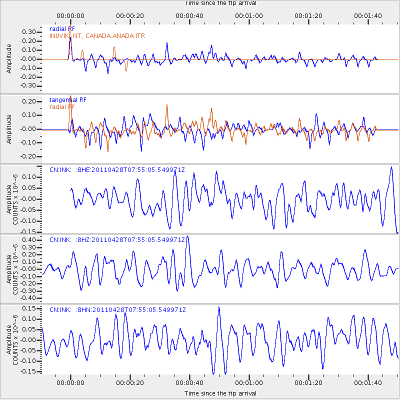
INK INUVIK, NT, CANADA.ANADA - Earthquake Result Viewer
*The percent match for this event was below the threshold and hence no stack was calculated.
| Earthquake location: |
Solomon Islands |
| Earthquake latitude/longitude: |
-10.0/160.5 |
| Earthquake time(UTC): |
2011/04/28 (118) 07:42:35 GMT |
| Earthquake Depth: |
14 km |
| Earthquake Magnitude: |
5.7 MW, 5.4 MS, 5.4 MB, 5.6 MW |
| Earthquake Catalog/Contributor: |
WHDF/NEIC |
|
| Network: |
CN Canadian National Seismograph Network |
| Station: |
INK INUVIK, NT, CANADA.ANADA |
| Lat/Lon: |
68.31 N/133.52 W |
| Elevation: |
40 m |
|
| Distance: |
90.6 deg |
| Az: |
19.855 deg |
| Baz: |
244.149 deg |
| Ray Param: |
$rayparam |
*The percent match for this event was below the threshold and hence was not used in the summary stack. |
|
| Radial Match: |
54.790356 % |
| Radial Bump: |
400 |
| Transverse Match: |
57.09857 % |
| Transverse Bump: |
400 |
| SOD ConfigId: |
356183 |
| Insert Time: |
2011-10-01 09:22:27.446 +0000 |
| GWidth: |
2.5 |
| Max Bumps: |
400 |
| Tol: |
0.001 |
|
Signal To Noise
| Channel | StoN | STA | LTA |
| CN:INK: :BHZ:20110428T07:55:05.549971Z | 1.9462932 | 1.5560884E-7 | 7.995139E-8 |
| CN:INK: :BHN:20110428T07:55:05.549971Z | 0.9654063 | 4.7854126E-8 | 4.9568897E-8 |
| CN:INK: :BHE:20110428T07:55:05.549971Z | 2.0181446 | 7.253804E-8 | 3.5942936E-8 |
| Arrivals |
| Ps | |
| PpPs | |
| PsPs/PpSs | |


