You are here: Home > Network List > TA - USArray Transportable Network (new EarthScope stations) Stations List
> Station O03D Paynes Creek, CA, USA > Earthquake Result Viewer
O03D Paynes Creek, CA, USA - Earthquake Result Viewer
*The percent match for this event was below the threshold and hence no stack was calculated.
| Earthquake location: |
Solomon Islands |
| Earthquake latitude/longitude: |
-10.0/160.5 |
| Earthquake time(UTC): |
2011/04/28 (118) 07:42:35 GMT |
| Earthquake Depth: |
14 km |
| Earthquake Magnitude: |
5.7 MW, 5.4 MS, 5.4 MB, 5.6 MW |
| Earthquake Catalog/Contributor: |
WHDF/NEIC |
|
| Network: |
TA USArray Transportable Network (new EarthScope stations) |
| Station: |
O03D Paynes Creek, CA, USA |
| Lat/Lon: |
40.29 N/121.80 W |
| Elevation: |
968 m |
|
| Distance: |
87.2 deg |
| Az: |
48.44 deg |
| Baz: |
254.515 deg |
| Ray Param: |
$rayparam |
*The percent match for this event was below the threshold and hence was not used in the summary stack. |
|
| Radial Match: |
53.019493 % |
| Radial Bump: |
400 |
| Transverse Match: |
42.704494 % |
| Transverse Bump: |
400 |
| SOD ConfigId: |
356183 |
| Insert Time: |
2011-10-01 09:29:50.751 +0000 |
| GWidth: |
2.5 |
| Max Bumps: |
400 |
| Tol: |
0.001 |
|
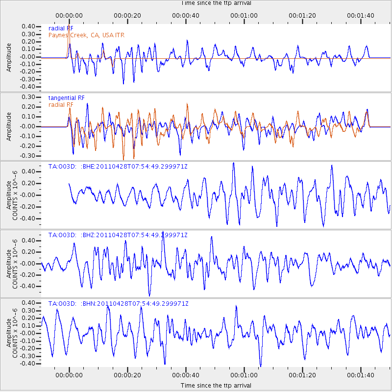
Signal To Noise
| Channel | StoN | STA | LTA |
| TA:O03D: :BHZ:20110428T07:54:49.299971Z | 2.5346718 | 2.0963066E-7 | 8.270525E-8 |
| TA:O03D: :BHN:20110428T07:54:49.299971Z | 0.95102996 | 1.3925032E-7 | 1.4642055E-7 |
| TA:O03D: :BHE:20110428T07:54:49.299971Z | 1.3550208 | 1.2679381E-7 | 9.357333E-8 |
| Arrivals |
| Ps | |
| PpPs | |
| PsPs/PpSs | |


