You are here: Home > Network List > US - United States National Seismic Network Stations List
> Station HAWA Hanford, Washington, USA > Earthquake Result Viewer
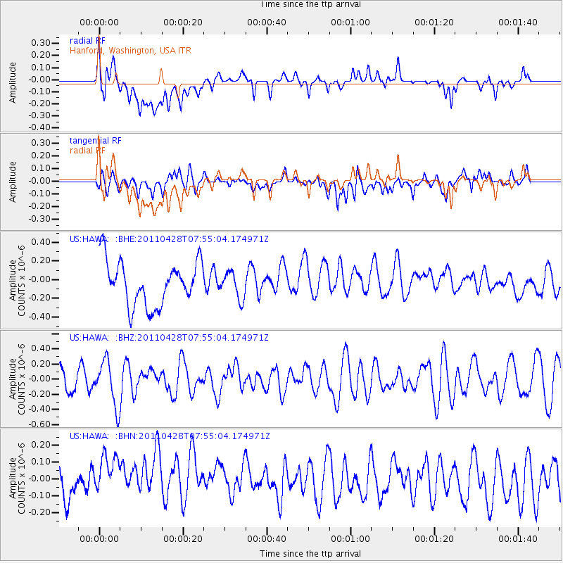
HAWA Hanford, Washington, USA - Earthquake Result Viewer
*The percent match for this event was below the threshold and hence no stack was calculated.
| Earthquake location: |
Solomon Islands |
| Earthquake latitude/longitude: |
-10.0/160.5 |
| Earthquake time(UTC): |
2011/04/28 (118) 07:42:35 GMT |
| Earthquake Depth: |
14 km |
| Earthquake Magnitude: |
5.7 MW, 5.4 MS, 5.4 MB, 5.6 MW |
| Earthquake Catalog/Contributor: |
WHDF/NEIC |
|
| Network: |
US United States National Seismic Network |
| Station: |
HAWA Hanford, Washington, USA |
| Lat/Lon: |
46.39 N/119.53 W |
| Elevation: |
364 m |
|
| Distance: |
90.3 deg |
| Az: |
42.968 deg |
| Baz: |
255.949 deg |
| Ray Param: |
$rayparam |
*The percent match for this event was below the threshold and hence was not used in the summary stack. |
|
| Radial Match: |
46.438614 % |
| Radial Bump: |
400 |
| Transverse Match: |
41.361633 % |
| Transverse Bump: |
400 |
| SOD ConfigId: |
356183 |
| Insert Time: |
2011-10-01 09:33:07.305 +0000 |
| GWidth: |
2.5 |
| Max Bumps: |
400 |
| Tol: |
0.001 |
|
Signal To Noise
| Channel | StoN | STA | LTA |
| US:HAWA: :BHZ:20110428T07:55:04.174971Z | 1.8631994 | 3.0847664E-7 | 1.6556288E-7 |
| US:HAWA: :BHN:20110428T07:55:04.174971Z | 2.0755954 | 2.0119688E-7 | 9.693454E-8 |
| US:HAWA: :BHE:20110428T07:55:04.174971Z | 0.605274 | 1.4323713E-7 | 2.3664839E-7 |
| Arrivals |
| Ps | |
| PpPs | |
| PsPs/PpSs | |


