You are here: Home > Network List > TA - USArray Transportable Network (new EarthScope stations) Stations List
> Station R11A Troy Canyon, Currant, NV, USA > Earthquake Result Viewer
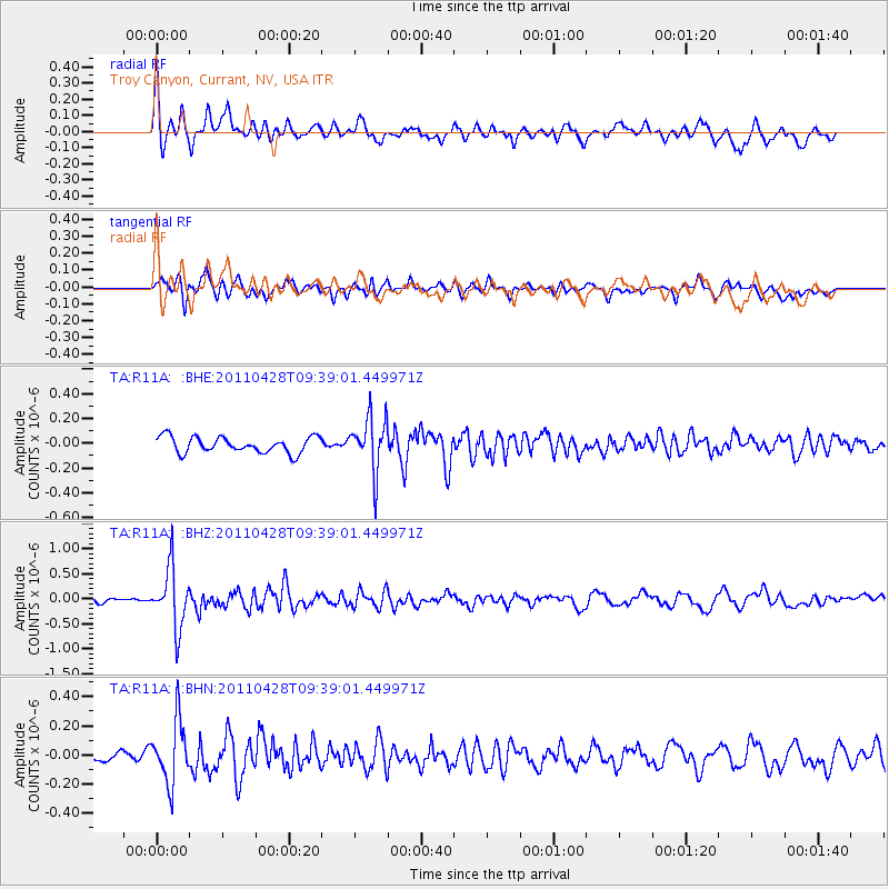
R11A Troy Canyon, Currant, NV, USA - Earthquake Result Viewer
*The percent match for this event was below the threshold and hence no stack was calculated.
| Earthquake location: |
Near East Coast Of Honshu, Japan |
| Earthquake latitude/longitude: |
37.5/141.7 |
| Earthquake time(UTC): |
2011/04/28 (118) 09:27:47 GMT |
| Earthquake Depth: |
38 km |
| Earthquake Magnitude: |
5.8 MB, 5.1 MS, 5.6 MW, 5.5 MW |
| Earthquake Catalog/Contributor: |
WHDF/NEIC |
|
| Network: |
TA USArray Transportable Network (new EarthScope stations) |
| Station: |
R11A Troy Canyon, Currant, NV, USA |
| Lat/Lon: |
38.35 N/115.59 W |
| Elevation: |
1756 m |
|
| Distance: |
76.4 deg |
| Az: |
52.104 deg |
| Baz: |
306.995 deg |
| Ray Param: |
$rayparam |
*The percent match for this event was below the threshold and hence was not used in the summary stack. |
|
| Radial Match: |
70.58338 % |
| Radial Bump: |
400 |
| Transverse Match: |
57.488453 % |
| Transverse Bump: |
377 |
| SOD ConfigId: |
356183 |
| Insert Time: |
2011-10-01 10:50:47.153 +0000 |
| GWidth: |
2.5 |
| Max Bumps: |
400 |
| Tol: |
0.001 |
|
Signal To Noise
| Channel | StoN | STA | LTA |
| TA:R11A: :BHZ:20110428T09:39:01.449971Z | 8.771113 | 5.8840914E-7 | 6.708488E-8 |
| TA:R11A: :BHN:20110428T09:39:01.449971Z | 3.4826224 | 2.1030415E-7 | 6.0386725E-8 |
| TA:R11A: :BHE:20110428T09:39:01.449971Z | 3.3793926 | 2.1689613E-7 | 6.418198E-8 |
| Arrivals |
| Ps | |
| PpPs | |
| PsPs/PpSs | |


