You are here: Home > Network List > TA - USArray Transportable Network (new EarthScope stations) Stations List
> Station SFIN Lafayette, IN, USA > Earthquake Result Viewer
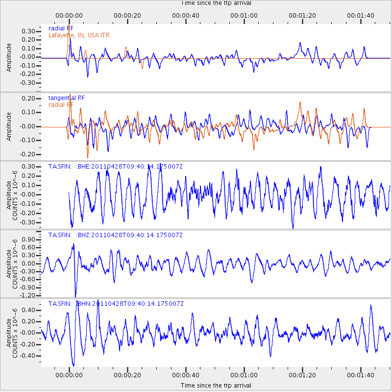
SFIN Lafayette, IN, USA - Earthquake Result Viewer
*The percent match for this event was below the threshold and hence no stack was calculated.
| Earthquake location: |
Near East Coast Of Honshu, Japan |
| Earthquake latitude/longitude: |
37.5/141.7 |
| Earthquake time(UTC): |
2011/04/28 (118) 09:27:47 GMT |
| Earthquake Depth: |
38 km |
| Earthquake Magnitude: |
5.8 MB, 5.1 MS, 5.6 MW, 5.5 MW |
| Earthquake Catalog/Contributor: |
WHDF/NEIC |
|
| Network: |
TA USArray Transportable Network (new EarthScope stations) |
| Station: |
SFIN Lafayette, IN, USA |
| Lat/Lon: |
40.38 N/87.10 W |
| Elevation: |
165 m |
|
| Distance: |
90.6 deg |
| Az: |
35.056 deg |
| Baz: |
323.249 deg |
| Ray Param: |
$rayparam |
*The percent match for this event was below the threshold and hence was not used in the summary stack. |
|
| Radial Match: |
57.388622 % |
| Radial Bump: |
400 |
| Transverse Match: |
44.362984 % |
| Transverse Bump: |
400 |
| SOD ConfigId: |
356183 |
| Insert Time: |
2011-10-01 10:55:58.786 +0000 |
| GWidth: |
2.5 |
| Max Bumps: |
400 |
| Tol: |
0.001 |
|
Signal To Noise
| Channel | StoN | STA | LTA |
| TA:SFIN: :BHZ:20110428T09:40:14.175007Z | 2.72133 | 4.778929E-7 | 1.7561005E-7 |
| TA:SFIN: :BHN:20110428T09:40:14.175007Z | 2.5928206 | 3.5754772E-7 | 1.3789912E-7 |
| TA:SFIN: :BHE:20110428T09:40:14.175007Z | 1.0566435 | 1.6551121E-7 | 1.5663865E-7 |
| Arrivals |
| Ps | |
| PpPs | |
| PsPs/PpSs | |


