You are here: Home > Network List > TA - USArray Transportable Network (new EarthScope stations) Stations List
> Station F29A Eureka, SD, USA > Earthquake Result Viewer
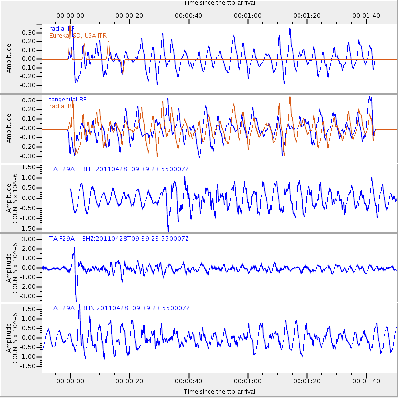
F29A Eureka, SD, USA - Earthquake Result Viewer
*The percent match for this event was below the threshold and hence no stack was calculated.
| Earthquake location: |
Near East Coast Of Honshu, Japan |
| Earthquake latitude/longitude: |
37.5/141.7 |
| Earthquake time(UTC): |
2011/04/28 (118) 09:27:47 GMT |
| Earthquake Depth: |
38 km |
| Earthquake Magnitude: |
5.8 MB, 5.1 MS, 5.6 MW, 5.5 MW |
| Earthquake Catalog/Contributor: |
WHDF/NEIC |
|
| Network: |
TA USArray Transportable Network (new EarthScope stations) |
| Station: |
F29A Eureka, SD, USA |
| Lat/Lon: |
45.83 N/99.83 W |
| Elevation: |
575 m |
|
| Distance: |
80.4 deg |
| Az: |
38.542 deg |
| Baz: |
314.828 deg |
| Ray Param: |
$rayparam |
*The percent match for this event was below the threshold and hence was not used in the summary stack. |
|
| Radial Match: |
59.479485 % |
| Radial Bump: |
400 |
| Transverse Match: |
58.841457 % |
| Transverse Bump: |
400 |
| SOD ConfigId: |
356183 |
| Insert Time: |
2011-10-01 11:23:57.191 +0000 |
| GWidth: |
2.5 |
| Max Bumps: |
400 |
| Tol: |
0.001 |
|
Signal To Noise
| Channel | StoN | STA | LTA |
| TA:F29A: :BHZ:20110428T09:39:23.550007Z | 10.699019 | 1.2340162E-6 | 1.1533918E-7 |
| TA:F29A: :BHN:20110428T09:39:23.550007Z | 1.9985762 | 6.3911426E-7 | 3.197848E-7 |
| TA:F29A: :BHE:20110428T09:39:23.550007Z | 1.6302847 | 5.797826E-7 | 3.5563272E-7 |
| Arrivals |
| Ps | |
| PpPs | |
| PsPs/PpSs | |


