You are here: Home > Network List > TA - USArray Transportable Network (new EarthScope stations) Stations List
> Station W36A Wetumka, OK, USA > Earthquake Result Viewer
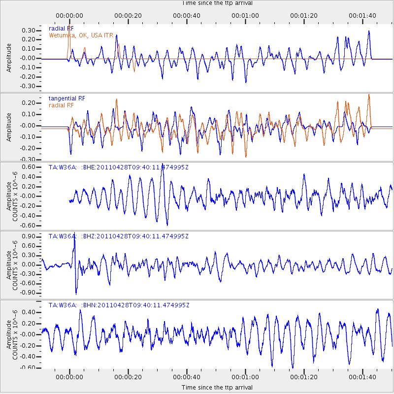
W36A Wetumka, OK, USA - Earthquake Result Viewer
*The percent match for this event was below the threshold and hence no stack was calculated.
| Earthquake location: |
Near East Coast Of Honshu, Japan |
| Earthquake latitude/longitude: |
37.5/141.7 |
| Earthquake time(UTC): |
2011/04/28 (118) 09:27:47 GMT |
| Earthquake Depth: |
38 km |
| Earthquake Magnitude: |
5.8 MB, 5.1 MS, 5.6 MW, 5.5 MW |
| Earthquake Catalog/Contributor: |
WHDF/NEIC |
|
| Network: |
TA USArray Transportable Network (new EarthScope stations) |
| Station: |
W36A Wetumka, OK, USA |
| Lat/Lon: |
35.14 N/96.23 W |
| Elevation: |
251 m |
|
| Distance: |
90.0 deg |
| Az: |
43.957 deg |
| Baz: |
317.625 deg |
| Ray Param: |
$rayparam |
*The percent match for this event was below the threshold and hence was not used in the summary stack. |
|
| Radial Match: |
46.350437 % |
| Radial Bump: |
339 |
| Transverse Match: |
54.089504 % |
| Transverse Bump: |
372 |
| SOD ConfigId: |
356183 |
| Insert Time: |
2011-10-01 12:04:09.286 +0000 |
| GWidth: |
2.5 |
| Max Bumps: |
400 |
| Tol: |
0.001 |
|
Signal To Noise
| Channel | StoN | STA | LTA |
| TA:W36A: :BHZ:20110428T09:40:11.474995Z | 4.069355 | 3.9835172E-7 | 9.7890634E-8 |
| TA:W36A: :BHN:20110428T09:40:11.474995Z | 1.862468 | 2.1616752E-7 | 1.16065095E-7 |
| TA:W36A: :BHE:20110428T09:40:11.474995Z | 2.0497825 | 3.7825086E-7 | 1.8453218E-7 |
| Arrivals |
| Ps | |
| PpPs | |
| PsPs/PpSs | |


