You are here: Home > Network List > TA - USArray Transportable Network (new EarthScope stations) Stations List
> Station M34A Aspy Farms, Fremont, NE, USA > Earthquake Result Viewer
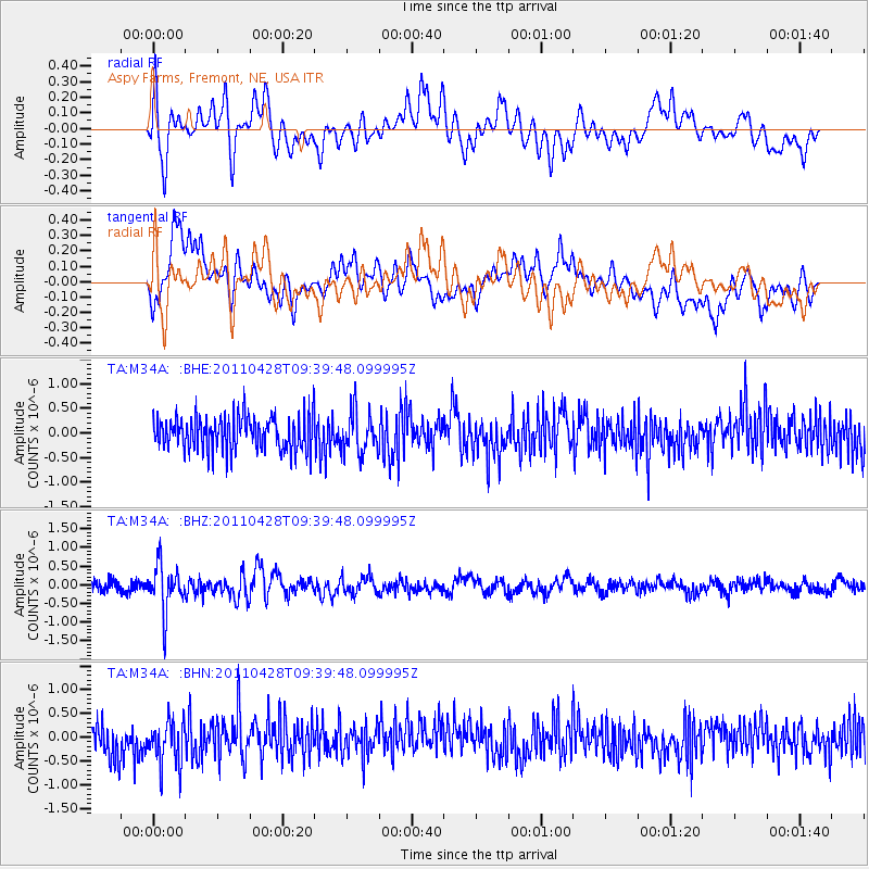
M34A Aspy Farms, Fremont, NE, USA - Earthquake Result Viewer
*The percent match for this event was below the threshold and hence no stack was calculated.
| Earthquake location: |
Near East Coast Of Honshu, Japan |
| Earthquake latitude/longitude: |
37.5/141.7 |
| Earthquake time(UTC): |
2011/04/28 (118) 09:27:47 GMT |
| Earthquake Depth: |
38 km |
| Earthquake Magnitude: |
5.8 MB, 5.1 MS, 5.6 MW, 5.5 MW |
| Earthquake Catalog/Contributor: |
WHDF/NEIC |
|
| Network: |
TA USArray Transportable Network (new EarthScope stations) |
| Station: |
M34A Aspy Farms, Fremont, NE, USA |
| Lat/Lon: |
41.50 N/96.58 W |
| Elevation: |
415 m |
|
| Distance: |
85.1 deg |
| Az: |
39.863 deg |
| Baz: |
317.229 deg |
| Ray Param: |
$rayparam |
*The percent match for this event was below the threshold and hence was not used in the summary stack. |
|
| Radial Match: |
62.06571 % |
| Radial Bump: |
400 |
| Transverse Match: |
64.31541 % |
| Transverse Bump: |
400 |
| SOD ConfigId: |
356183 |
| Insert Time: |
2011-10-01 12:19:27.964 +0000 |
| GWidth: |
2.5 |
| Max Bumps: |
400 |
| Tol: |
0.001 |
|
Signal To Noise
| Channel | StoN | STA | LTA |
| TA:M34A: :BHZ:20110428T09:39:48.099995Z | 4.3058906 | 6.152541E-7 | 1.428866E-7 |
| TA:M34A: :BHN:20110428T09:39:48.099995Z | 1.4796593 | 4.7273915E-7 | 3.1949187E-7 |
| TA:M34A: :BHE:20110428T09:39:48.099995Z | 1.2262605 | 4.2299897E-7 | 3.449503E-7 |
| Arrivals |
| Ps | |
| PpPs | |
| PsPs/PpSs | |


