You are here: Home > Network List > TA - USArray Transportable Network (new EarthScope stations) Stations List
> Station L32A Elgin, NE, USA > Earthquake Result Viewer
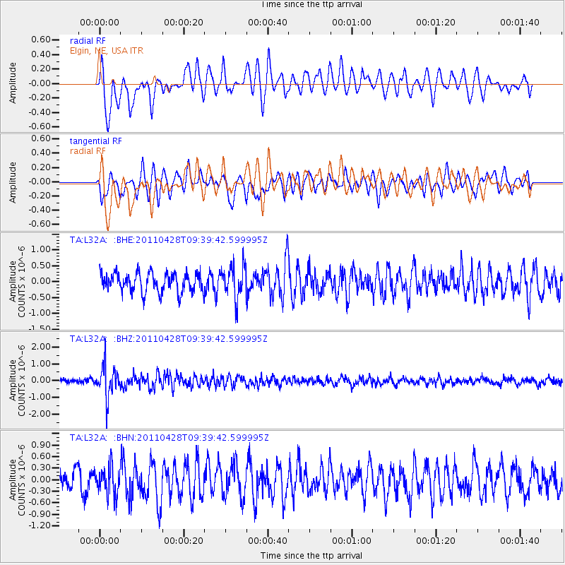
L32A Elgin, NE, USA - Earthquake Result Viewer
*The percent match for this event was below the threshold and hence no stack was calculated.
| Earthquake location: |
Near East Coast Of Honshu, Japan |
| Earthquake latitude/longitude: |
37.5/141.7 |
| Earthquake time(UTC): |
2011/04/28 (118) 09:27:47 GMT |
| Earthquake Depth: |
38 km |
| Earthquake Magnitude: |
5.8 MB, 5.1 MS, 5.6 MW, 5.5 MW |
| Earthquake Catalog/Contributor: |
WHDF/NEIC |
|
| Network: |
TA USArray Transportable Network (new EarthScope stations) |
| Station: |
L32A Elgin, NE, USA |
| Lat/Lon: |
42.00 N/98.01 W |
| Elevation: |
586 m |
|
| Distance: |
84.0 deg |
| Az: |
40.298 deg |
| Baz: |
316.325 deg |
| Ray Param: |
$rayparam |
*The percent match for this event was below the threshold and hence was not used in the summary stack. |
|
| Radial Match: |
74.72969 % |
| Radial Bump: |
400 |
| Transverse Match: |
73.16815 % |
| Transverse Bump: |
400 |
| SOD ConfigId: |
356183 |
| Insert Time: |
2011-10-01 12:28:09.743 +0000 |
| GWidth: |
2.5 |
| Max Bumps: |
400 |
| Tol: |
0.001 |
|
Signal To Noise
| Channel | StoN | STA | LTA |
| TA:L32A: :BHZ:20110428T09:39:42.599995Z | 9.307597 | 9.4433256E-7 | 1.0145825E-7 |
| TA:L32A: :BHN:20110428T09:39:42.599995Z | 1.8879195 | 3.6669746E-7 | 1.9423364E-7 |
| TA:L32A: :BHE:20110428T09:39:42.599995Z | 1.7413704 | 5.1921296E-7 | 2.9816346E-7 |
| Arrivals |
| Ps | |
| PpPs | |
| PsPs/PpSs | |


