You are here: Home > Network List > US - United States National Seismic Network Stations List
> Station DGMT Dagmar, Montana, USA > Earthquake Result Viewer
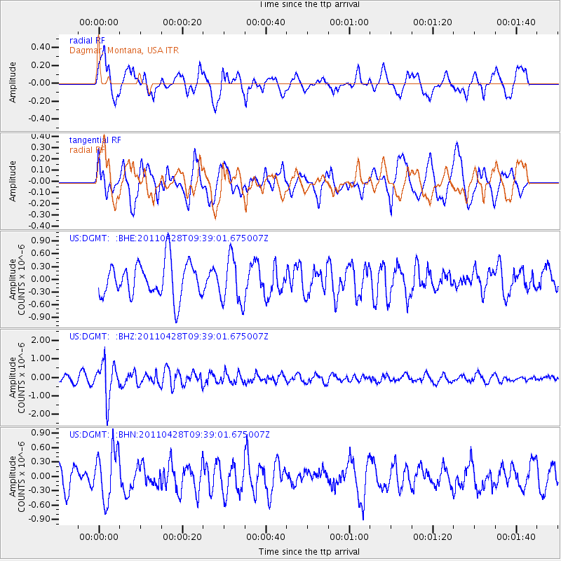
DGMT Dagmar, Montana, USA - Earthquake Result Viewer
*The percent match for this event was below the threshold and hence no stack was calculated.
| Earthquake location: |
Near East Coast Of Honshu, Japan |
| Earthquake latitude/longitude: |
37.5/141.7 |
| Earthquake time(UTC): |
2011/04/28 (118) 09:27:47 GMT |
| Earthquake Depth: |
38 km |
| Earthquake Magnitude: |
5.8 MB, 5.1 MS, 5.6 MW, 5.5 MW |
| Earthquake Catalog/Contributor: |
WHDF/NEIC |
|
| Network: |
US United States National Seismic Network |
| Station: |
DGMT Dagmar, Montana, USA |
| Lat/Lon: |
48.47 N/104.20 W |
| Elevation: |
0.0 m |
|
| Distance: |
76.4 deg |
| Az: |
38.667 deg |
| Baz: |
311.659 deg |
| Ray Param: |
$rayparam |
*The percent match for this event was below the threshold and hence was not used in the summary stack. |
|
| Radial Match: |
48.975933 % |
| Radial Bump: |
400 |
| Transverse Match: |
53.651142 % |
| Transverse Bump: |
400 |
| SOD ConfigId: |
356183 |
| Insert Time: |
2011-10-01 13:22:25.235 +0000 |
| GWidth: |
2.5 |
| Max Bumps: |
400 |
| Tol: |
0.001 |
|
Signal To Noise
| Channel | StoN | STA | LTA |
| US:DGMT: :BHZ:20110428T09:39:01.675007Z | 6.3816566 | 9.798279E-7 | 1.5353817E-7 |
| US:DGMT: :BHN:20110428T09:39:01.675007Z | 1.8224504 | 5.399025E-7 | 2.9625087E-7 |
| US:DGMT: :BHE:20110428T09:39:01.675007Z | 1.3458054 | 5.539195E-7 | 4.115896E-7 |
| Arrivals |
| Ps | |
| PpPs | |
| PsPs/PpSs | |


