You are here: Home > Network List > CN - Canadian National Seismograph Network Stations List
> Station INK INUVIK, NT, CANADA.ANADA > Earthquake Result Viewer
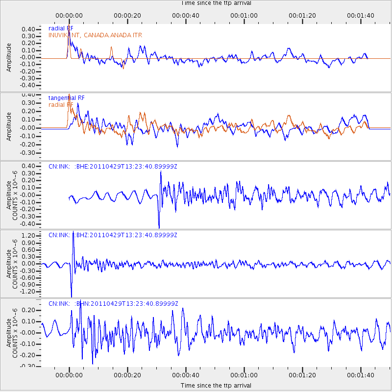
INK INUVIK, NT, CANADA.ANADA - Earthquake Result Viewer
*The percent match for this event was below the threshold and hence no stack was calculated.
| Earthquake location: |
Taiwan Region |
| Earthquake latitude/longitude: |
21.1/122.0 |
| Earthquake time(UTC): |
2011/04/29 (119) 13:12:46 GMT |
| Earthquake Depth: |
181 km |
| Earthquake Magnitude: |
5.5 MB, 5.4 MW, 5.3 MW |
| Earthquake Catalog/Contributor: |
WHDF/NEIC |
|
| Network: |
CN Canadian National Seismograph Network |
| Station: |
INK INUVIK, NT, CANADA.ANADA |
| Lat/Lon: |
68.31 N/133.52 W |
| Elevation: |
40 m |
|
| Distance: |
75.8 deg |
| Az: |
21.802 deg |
| Baz: |
291.158 deg |
| Ray Param: |
$rayparam |
*The percent match for this event was below the threshold and hence was not used in the summary stack. |
|
| Radial Match: |
51.732883 % |
| Radial Bump: |
400 |
| Transverse Match: |
44.835365 % |
| Transverse Bump: |
400 |
| SOD ConfigId: |
356183 |
| Insert Time: |
2011-10-01 14:03:33.884 +0000 |
| GWidth: |
2.5 |
| Max Bumps: |
400 |
| Tol: |
0.001 |
|
Signal To Noise
| Channel | StoN | STA | LTA |
| CN:INK: :BHZ:20110429T13:23:40.89999Z | 7.9222045 | 4.982961E-7 | 6.289867E-8 |
| CN:INK: :BHN:20110429T13:23:40.89999Z | 2.0300722 | 1.249812E-7 | 6.1564904E-8 |
| CN:INK: :BHE:20110429T13:23:40.89999Z | 3.5002458 | 1.5683985E-7 | 4.480824E-8 |
| Arrivals |
| Ps | |
| PpPs | |
| PsPs/PpSs | |


