You are here: Home > Network List > AV - Alaska Volcano Observatory Stations List
> Station SPCR Ckakachatna River, Mount Spurr, Alaska > Earthquake Result Viewer
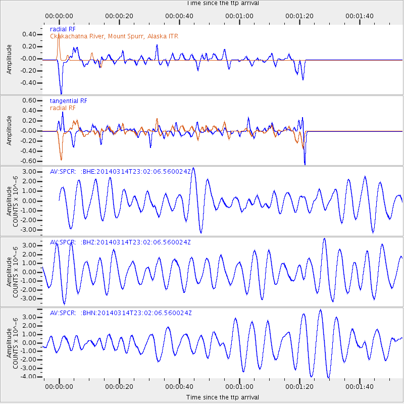
SPCR Ckakachatna River, Mount Spurr, Alaska - Earthquake Result Viewer
*The percent match for this event was below the threshold and hence no stack was calculated.
| Earthquake location: |
Tonga Islands Region |
| Earthquake latitude/longitude: |
-23.4/-175.3 |
| Earthquake time(UTC): |
2014/03/14 (073) 22:49:56 GMT |
| Earthquake Depth: |
14 km |
| Earthquake Magnitude: |
5.1 MW |
| Earthquake Catalog/Contributor: |
ISC/ISC |
|
| Network: |
AV Alaska Volcano Observatory |
| Station: |
SPCR Ckakachatna River, Mount Spurr, Alaska |
| Lat/Lon: |
61.20 N/152.21 W |
| Elevation: |
984 m |
|
| Distance: |
86.3 deg |
| Az: |
10.951 deg |
| Baz: |
201.13 deg |
| Ray Param: |
$rayparam |
*The percent match for this event was below the threshold and hence was not used in the summary stack. |
|
| Radial Match: |
53.28136 % |
| Radial Bump: |
400 |
| Transverse Match: |
67.72914 % |
| Transverse Bump: |
400 |
| SOD ConfigId: |
3390531 |
| Insert Time: |
2019-04-10 16:02:10.591 +0000 |
| GWidth: |
2.5 |
| Max Bumps: |
400 |
| Tol: |
0.001 |
|
Signal To Noise
| Channel | StoN | STA | LTA |
| AV:SPCR: :BHZ:20140314T23:02:06.560024Z | 2.1517823 | 2.5363013E-6 | 1.178698E-6 |
| AV:SPCR: :BHN:20140314T23:02:06.560024Z | 0.50408494 | 6.51492E-7 | 1.2924249E-6 |
| AV:SPCR: :BHE:20140314T23:02:06.560024Z | 0.61976194 | 8.6242085E-7 | 1.3915356E-6 |
| Arrivals |
| Ps | |
| PpPs | |
| PsPs/PpSs | |


