You are here: Home > Network List > TA - USArray Transportable Network (new EarthScope stations) Stations List
> Station 121A Cookes Peak, Deming, NM, USA > Earthquake Result Viewer
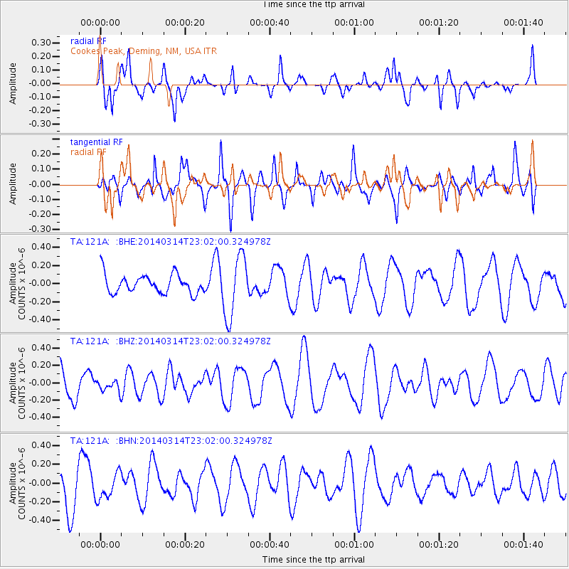
121A Cookes Peak, Deming, NM, USA - Earthquake Result Viewer
*The percent match for this event was below the threshold and hence no stack was calculated.
| Earthquake location: |
Tonga Islands Region |
| Earthquake latitude/longitude: |
-23.4/-175.3 |
| Earthquake time(UTC): |
2014/03/14 (073) 22:49:56 GMT |
| Earthquake Depth: |
14 km |
| Earthquake Magnitude: |
5.1 MW |
| Earthquake Catalog/Contributor: |
ISC/ISC |
|
| Network: |
TA USArray Transportable Network (new EarthScope stations) |
| Station: |
121A Cookes Peak, Deming, NM, USA |
| Lat/Lon: |
32.53 N/107.79 W |
| Elevation: |
1652 m |
|
| Distance: |
85.1 deg |
| Az: |
51.552 deg |
| Baz: |
238.425 deg |
| Ray Param: |
$rayparam |
*The percent match for this event was below the threshold and hence was not used in the summary stack. |
|
| Radial Match: |
60.72661 % |
| Radial Bump: |
324 |
| Transverse Match: |
49.616547 % |
| Transverse Bump: |
400 |
| SOD ConfigId: |
3390531 |
| Insert Time: |
2019-04-10 16:04:47.440 +0000 |
| GWidth: |
2.5 |
| Max Bumps: |
400 |
| Tol: |
0.001 |
|
Signal To Noise
| Channel | StoN | STA | LTA |
| TA:121A: :BHZ:20140314T23:02:00.324978Z | 0.37352714 | 6.425551E-8 | 1.7202368E-7 |
| TA:121A: :BHN:20140314T23:02:00.324978Z | 0.7078612 | 1.3906762E-7 | 1.9646173E-7 |
| TA:121A: :BHE:20140314T23:02:00.324978Z | 3.384072 | 3.4720844E-7 | 1.0260078E-7 |
| Arrivals |
| Ps | |
| PpPs | |
| PsPs/PpSs | |


