You are here: Home > Network List > TA - USArray Transportable Network (new EarthScope stations) Stations List
> Station O33A Hebron, NE, USA > Earthquake Result Viewer
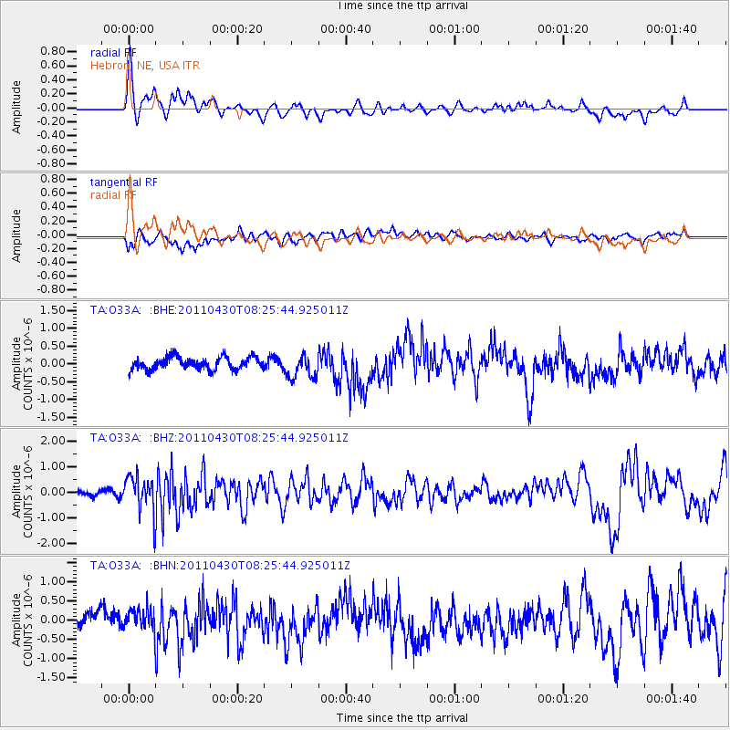
O33A Hebron, NE, USA - Earthquake Result Viewer
*The percent match for this event was below the threshold and hence no stack was calculated.
| Earthquake location: |
South Of Panama |
| Earthquake latitude/longitude: |
6.9/-82.3 |
| Earthquake time(UTC): |
2011/04/30 (120) 08:19:16 GMT |
| Earthquake Depth: |
8.0 km |
| Earthquake Magnitude: |
5.8 MB, 5.7 MS, 6.2 MW, 6.0 MW |
| Earthquake Catalog/Contributor: |
WHDF/NEIC |
|
| Network: |
TA USArray Transportable Network (new EarthScope stations) |
| Station: |
O33A Hebron, NE, USA |
| Lat/Lon: |
40.08 N/97.58 W |
| Elevation: |
480 m |
|
| Distance: |
35.8 deg |
| Az: |
339.814 deg |
| Baz: |
153.478 deg |
| Ray Param: |
$rayparam |
*The percent match for this event was below the threshold and hence was not used in the summary stack. |
|
| Radial Match: |
70.83996 % |
| Radial Bump: |
400 |
| Transverse Match: |
55.776134 % |
| Transverse Bump: |
400 |
| SOD ConfigId: |
356183 |
| Insert Time: |
2011-10-06 05:24:03.102 +0000 |
| GWidth: |
2.5 |
| Max Bumps: |
400 |
| Tol: |
0.001 |
|
Signal To Noise
| Channel | StoN | STA | LTA |
| TA:O33A: :BHZ:20110430T08:25:44.925011Z | 7.4591093 | 6.9806066E-7 | 9.358499E-8 |
| TA:O33A: :BHN:20110430T08:25:44.925011Z | 0.9626098 | 2.9227925E-7 | 3.036321E-7 |
| TA:O33A: :BHE:20110430T08:25:44.925011Z | 2.0022764 | 3.475902E-7 | 1.7359751E-7 |
| Arrivals |
| Ps | |
| PpPs | |
| PsPs/PpSs | |


