You are here: Home > Network List > TA - USArray Transportable Network (new EarthScope stations) Stations List
> Station A04D Lummi Island, WA, USA > Earthquake Result Viewer
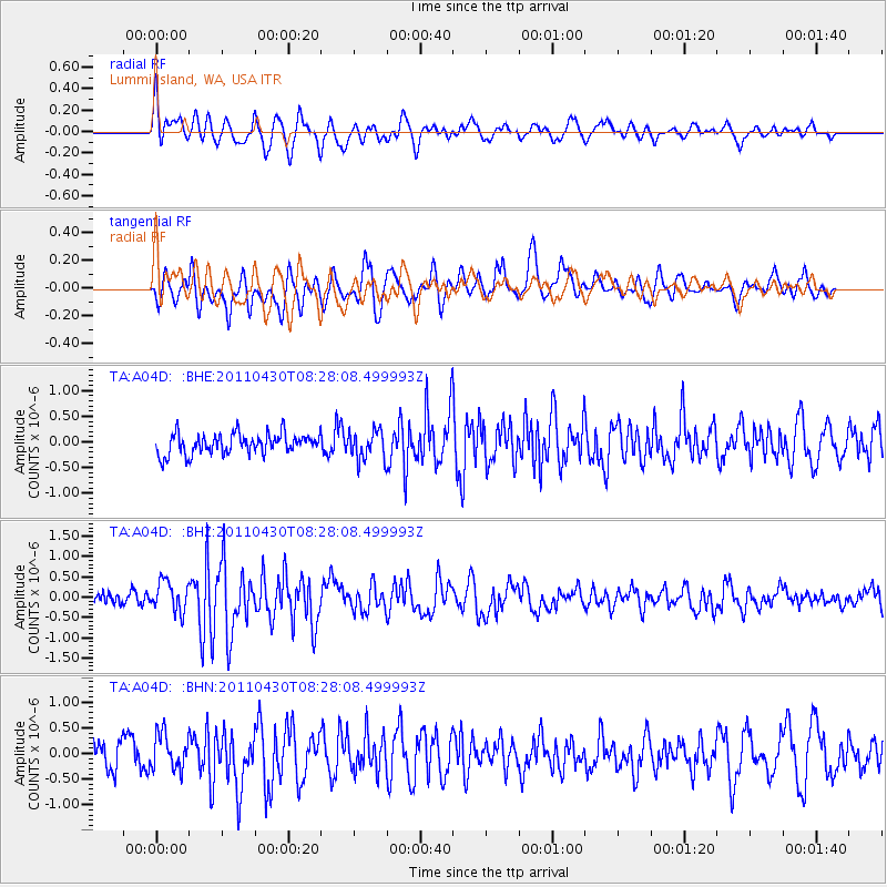
A04D Lummi Island, WA, USA - Earthquake Result Viewer
*The percent match for this event was below the threshold and hence no stack was calculated.
| Earthquake location: |
South Of Panama |
| Earthquake latitude/longitude: |
6.9/-82.3 |
| Earthquake time(UTC): |
2011/04/30 (120) 08:19:16 GMT |
| Earthquake Depth: |
8.0 km |
| Earthquake Magnitude: |
5.8 MB, 5.7 MS, 6.2 MW, 6.0 MW |
| Earthquake Catalog/Contributor: |
WHDF/NEIC |
|
| Network: |
TA USArray Transportable Network (new EarthScope stations) |
| Station: |
A04D Lummi Island, WA, USA |
| Lat/Lon: |
48.72 N/122.71 W |
| Elevation: |
13 m |
|
| Distance: |
53.9 deg |
| Az: |
327.914 deg |
| Baz: |
127.207 deg |
| Ray Param: |
$rayparam |
*The percent match for this event was below the threshold and hence was not used in the summary stack. |
|
| Radial Match: |
66.86864 % |
| Radial Bump: |
400 |
| Transverse Match: |
69.72534 % |
| Transverse Bump: |
400 |
| SOD ConfigId: |
356183 |
| Insert Time: |
2011-10-06 05:34:34.871 +0000 |
| GWidth: |
2.5 |
| Max Bumps: |
400 |
| Tol: |
0.001 |
|
Signal To Noise
| Channel | StoN | STA | LTA |
| TA:A04D: :BHZ:20110430T08:28:08.499993Z | 1.7786267 | 3.753753E-7 | 2.1104782E-7 |
| TA:A04D: :BHN:20110430T08:28:08.499993Z | 1.6086602 | 3.4676145E-7 | 2.1555917E-7 |
| TA:A04D: :BHE:20110430T08:28:08.499993Z | 1.42939 | 2.8371153E-7 | 1.9848433E-7 |
| Arrivals |
| Ps | |
| PpPs | |
| PsPs/PpSs | |


