You are here: Home > Network List > TA - USArray Transportable Network (new EarthScope stations) Stations List
> Station S38A Stockton, MO, USA > Earthquake Result Viewer
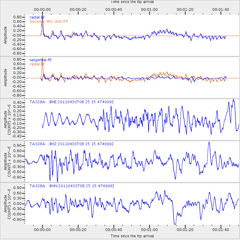
S38A Stockton, MO, USA - Earthquake Result Viewer
*The percent match for this event was below the threshold and hence no stack was calculated.
| Earthquake location: |
South Of Panama |
| Earthquake latitude/longitude: |
6.9/-82.3 |
| Earthquake time(UTC): |
2011/04/30 (120) 08:19:16 GMT |
| Earthquake Depth: |
8.0 km |
| Earthquake Magnitude: |
5.8 MB, 5.7 MS, 6.2 MW, 6.0 MW |
| Earthquake Catalog/Contributor: |
WHDF/NEIC |
|
| Network: |
TA USArray Transportable Network (new EarthScope stations) |
| Station: |
S38A Stockton, MO, USA |
| Lat/Lon: |
37.63 N/93.91 W |
| Elevation: |
294 m |
|
| Distance: |
32.4 deg |
| Az: |
342.702 deg |
| Baz: |
158.169 deg |
| Ray Param: |
$rayparam |
*The percent match for this event was below the threshold and hence was not used in the summary stack. |
|
| Radial Match: |
73.11175 % |
| Radial Bump: |
400 |
| Transverse Match: |
63.34391 % |
| Transverse Bump: |
400 |
| SOD ConfigId: |
356183 |
| Insert Time: |
2011-10-06 05:56:49.649 +0000 |
| GWidth: |
2.5 |
| Max Bumps: |
400 |
| Tol: |
0.001 |
|
Signal To Noise
| Channel | StoN | STA | LTA |
| TA:S38A: :BHZ:20110430T08:25:15.474999Z | 4.030905 | 3.830774E-7 | 9.503509E-8 |
| TA:S38A: :BHN:20110430T08:25:15.474999Z | 1.3227142 | 2.3649716E-7 | 1.7879687E-7 |
| TA:S38A: :BHE:20110430T08:25:15.474999Z | 1.2297052 | 1.11251914E-7 | 9.0470394E-8 |
| Arrivals |
| Ps | |
| PpPs | |
| PsPs/PpSs | |


