You are here: Home > Network List > TA - USArray Transportable Network (new EarthScope stations) Stations List
> Station M51A Elyria, OH, USA > Earthquake Result Viewer
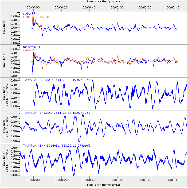
M51A Elyria, OH, USA - Earthquake Result Viewer
*The percent match for this event was below the threshold and hence no stack was calculated.
| Earthquake location: |
Venezuela |
| Earthquake latitude/longitude: |
10.3/-73.0 |
| Earthquake time(UTC): |
2014/03/14 (073) 23:26:35 GMT |
| Earthquake Depth: |
131 km |
| Earthquake Magnitude: |
5.0 MW |
| Earthquake Catalog/Contributor: |
ISC/ISC |
|
| Network: |
TA USArray Transportable Network (new EarthScope stations) |
| Station: |
M51A Elyria, OH, USA |
| Lat/Lon: |
41.33 N/82.18 W |
| Elevation: |
239 m |
|
| Distance: |
32.0 deg |
| Az: |
346.819 deg |
| Baz: |
162.663 deg |
| Ray Param: |
$rayparam |
*The percent match for this event was below the threshold and hence was not used in the summary stack. |
|
| Radial Match: |
50.227676 % |
| Radial Bump: |
400 |
| Transverse Match: |
53.00224 % |
| Transverse Bump: |
400 |
| SOD ConfigId: |
3390531 |
| Insert Time: |
2019-04-10 16:11:18.957 +0000 |
| GWidth: |
2.5 |
| Max Bumps: |
400 |
| Tol: |
0.001 |
|
Signal To Noise
| Channel | StoN | STA | LTA |
| TA:M51A: :BHZ:20140314T23:32:19.074996Z | 1.0202538 | 1.9534981E-7 | 1.9147178E-7 |
| TA:M51A: :BHN:20140314T23:32:19.074996Z | 0.9316663 | 2.4797632E-7 | 2.6616428E-7 |
| TA:M51A: :BHE:20140314T23:32:19.074996Z | 0.72190976 | 1.8436313E-7 | 2.5538253E-7 |
| Arrivals |
| Ps | |
| PpPs | |
| PsPs/PpSs | |


