You are here: Home > Network List > US - United States National Seismic Network Stations List
> Station HAWA Hanford, Washington, USA > Earthquake Result Viewer
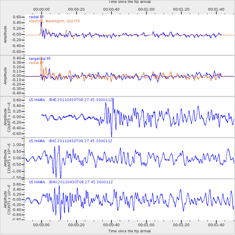
HAWA Hanford, Washington, USA - Earthquake Result Viewer
*The percent match for this event was below the threshold and hence no stack was calculated.
| Earthquake location: |
South Of Panama |
| Earthquake latitude/longitude: |
6.9/-82.3 |
| Earthquake time(UTC): |
2011/04/30 (120) 08:19:16 GMT |
| Earthquake Depth: |
8.0 km |
| Earthquake Magnitude: |
5.8 MB, 5.7 MS, 6.2 MW, 6.0 MW |
| Earthquake Catalog/Contributor: |
WHDF/NEIC |
|
| Network: |
US United States National Seismic Network |
| Station: |
HAWA Hanford, Washington, USA |
| Lat/Lon: |
46.39 N/119.53 W |
| Elevation: |
364 m |
|
| Distance: |
50.7 deg |
| Az: |
327.281 deg |
| Baz: |
129.155 deg |
| Ray Param: |
$rayparam |
*The percent match for this event was below the threshold and hence was not used in the summary stack. |
|
| Radial Match: |
55.579224 % |
| Radial Bump: |
400 |
| Transverse Match: |
55.94359 % |
| Transverse Bump: |
400 |
| SOD ConfigId: |
356183 |
| Insert Time: |
2011-10-06 06:05:11.347 +0000 |
| GWidth: |
2.5 |
| Max Bumps: |
400 |
| Tol: |
0.001 |
|
Signal To Noise
| Channel | StoN | STA | LTA |
| US:HAWA: :BHZ:20110430T08:27:45.300011Z | 2.2411308 | 3.208051E-7 | 1.431443E-7 |
| US:HAWA: :BHN:20110430T08:27:45.300011Z | 1.4590834 | 1.5842367E-7 | 1.0857753E-7 |
| US:HAWA: :BHE:20110430T08:27:45.300011Z | 2.1413581 | 1.2332924E-7 | 5.7593933E-8 |
| Arrivals |
| Ps | |
| PpPs | |
| PsPs/PpSs | |


