You are here: Home > Network List > US - United States National Seismic Network Stations List
> Station AMTX Amarillo, Texas, USA > Earthquake Result Viewer
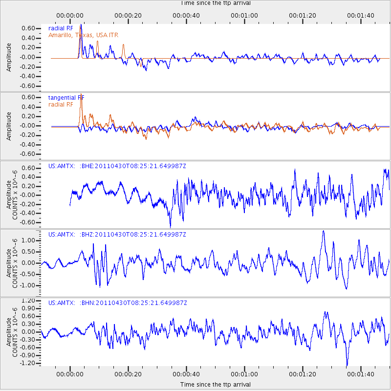
AMTX Amarillo, Texas, USA - Earthquake Result Viewer
*The percent match for this event was below the threshold and hence no stack was calculated.
| Earthquake location: |
South Of Panama |
| Earthquake latitude/longitude: |
6.9/-82.3 |
| Earthquake time(UTC): |
2011/04/30 (120) 08:19:16 GMT |
| Earthquake Depth: |
8.0 km |
| Earthquake Magnitude: |
5.8 MB, 5.7 MS, 6.2 MW, 6.0 MW |
| Earthquake Catalog/Contributor: |
WHDF/NEIC |
|
| Network: |
US United States National Seismic Network |
| Station: |
AMTX Amarillo, Texas, USA |
| Lat/Lon: |
34.53 N/101.41 W |
| Elevation: |
1010 m |
|
| Distance: |
32.7 deg |
| Az: |
330.026 deg |
| Baz: |
143.066 deg |
| Ray Param: |
$rayparam |
*The percent match for this event was below the threshold and hence was not used in the summary stack. |
|
| Radial Match: |
71.855385 % |
| Radial Bump: |
400 |
| Transverse Match: |
50.270256 % |
| Transverse Bump: |
400 |
| SOD ConfigId: |
356183 |
| Insert Time: |
2011-10-06 06:06:43.041 +0000 |
| GWidth: |
2.5 |
| Max Bumps: |
400 |
| Tol: |
0.001 |
|
Signal To Noise
| Channel | StoN | STA | LTA |
| US:AMTX: :BHZ:20110430T08:25:21.649987Z | 1.9977498 | 2.7842248E-7 | 1.3936804E-7 |
| US:AMTX: :BHN:20110430T08:25:21.649987Z | 0.5628443 | 9.283478E-8 | 1.6493867E-7 |
| US:AMTX: :BHE:20110430T08:25:21.649987Z | 1.8052368 | 2.1634791E-7 | 1.1984461E-7 |
| Arrivals |
| Ps | |
| PpPs | |
| PsPs/PpSs | |


