You are here: Home > Network List > US - United States National Seismic Network Stations List
> Station EGMT Eagleton, Montana, USA > Earthquake Result Viewer
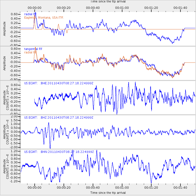
EGMT Eagleton, Montana, USA - Earthquake Result Viewer
*The percent match for this event was below the threshold and hence no stack was calculated.
| Earthquake location: |
South Of Panama |
| Earthquake latitude/longitude: |
6.9/-82.3 |
| Earthquake time(UTC): |
2011/04/30 (120) 08:19:16 GMT |
| Earthquake Depth: |
8.0 km |
| Earthquake Magnitude: |
5.8 MB, 5.7 MS, 6.2 MW, 6.0 MW |
| Earthquake Catalog/Contributor: |
WHDF/NEIC |
|
| Network: |
US United States National Seismic Network |
| Station: |
EGMT Eagleton, Montana, USA |
| Lat/Lon: |
48.02 N/109.75 W |
| Elevation: |
1055 m |
|
| Distance: |
47.2 deg |
| Az: |
335.078 deg |
| Baz: |
141.443 deg |
| Ray Param: |
$rayparam |
*The percent match for this event was below the threshold and hence was not used in the summary stack. |
|
| Radial Match: |
50.88525 % |
| Radial Bump: |
400 |
| Transverse Match: |
55.53228 % |
| Transverse Bump: |
400 |
| SOD ConfigId: |
356183 |
| Insert Time: |
2011-10-06 06:07:26.328 +0000 |
| GWidth: |
2.5 |
| Max Bumps: |
400 |
| Tol: |
0.001 |
|
Signal To Noise
| Channel | StoN | STA | LTA |
| US:EGMT: :BHZ:20110430T08:27:18.224999Z | 2.8763368 | 3.310859E-7 | 1.15106786E-7 |
| US:EGMT: :BHN:20110430T08:27:18.224999Z | 0.65732914 | 4.739672E-7 | 7.2105E-7 |
| US:EGMT: :BHE:20110430T08:27:18.224999Z | 1.4279052 | 2.5343107E-7 | 1.7748451E-7 |
| Arrivals |
| Ps | |
| PpPs | |
| PsPs/PpSs | |


