You are here: Home > Network List > US - United States National Seismic Network Stations List
> Station WRAK Wrangell Island, Southeastern Alaska, Alaska, USA > Earthquake Result Viewer
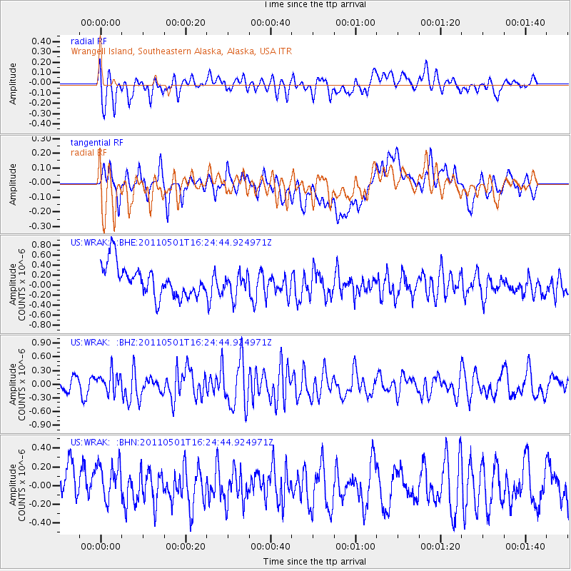
WRAK Wrangell Island, Southeastern Alaska, Alaska, USA - Earthquake Result Viewer
*The percent match for this event was below the threshold and hence no stack was calculated.
| Earthquake location: |
Solomon Islands |
| Earthquake latitude/longitude: |
-7.0/155.9 |
| Earthquake time(UTC): |
2011/05/01 (121) 16:12:42 GMT |
| Earthquake Depth: |
55 km |
| Earthquake Magnitude: |
5.8 MB, 5.9 MW, 5.8 MW |
| Earthquake Catalog/Contributor: |
WHDF/NEIC |
|
| Network: |
US United States National Seismic Network |
| Station: |
WRAK Wrangell Island, Southeastern Alaska, Alaska, USA |
| Lat/Lon: |
56.42 N/132.35 W |
| Elevation: |
81 m |
|
| Distance: |
85.9 deg |
| Az: |
31.956 deg |
| Baz: |
251.003 deg |
| Ray Param: |
$rayparam |
*The percent match for this event was below the threshold and hence was not used in the summary stack. |
|
| Radial Match: |
61.31071 % |
| Radial Bump: |
400 |
| Transverse Match: |
37.424873 % |
| Transverse Bump: |
400 |
| SOD ConfigId: |
356183 |
| Insert Time: |
2011-10-06 06:40:42.895 +0000 |
| GWidth: |
2.5 |
| Max Bumps: |
400 |
| Tol: |
0.001 |
|
Signal To Noise
| Channel | StoN | STA | LTA |
| US:WRAK: :BHZ:20110501T16:24:44.924971Z | 1.2121214 | 2.2564254E-7 | 1.8615508E-7 |
| US:WRAK: :BHN:20110501T16:24:44.924971Z | 0.73589605 | 2.6843819E-7 | 3.647773E-7 |
| US:WRAK: :BHE:20110501T16:24:44.924971Z | 0.74032694 | 2.3076369E-7 | 3.117051E-7 |
| Arrivals |
| Ps | |
| PpPs | |
| PsPs/PpSs | |


