You are here: Home > Network List > MN - MEDNET Project Stations List
> Station TIP Timpagrande, Italy > Earthquake Result Viewer
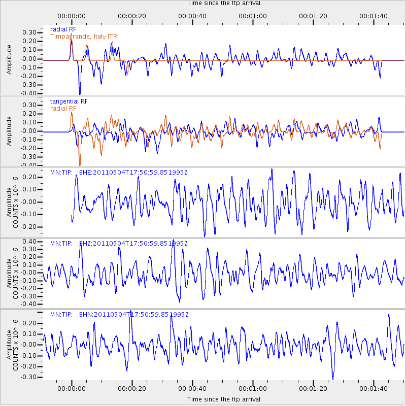
TIP Timpagrande, Italy - Earthquake Result Viewer
*The percent match for this event was below the threshold and hence no stack was calculated.
| Earthquake location: |
Southern Sumatra, Indonesia |
| Earthquake latitude/longitude: |
-4.9/101.8 |
| Earthquake time(UTC): |
2011/05/04 (124) 17:38:37 GMT |
| Earthquake Depth: |
26 km |
| Earthquake Magnitude: |
5.5 MW, 5.3 MS, 5.4 MB, 5.4 MW |
| Earthquake Catalog/Contributor: |
WHDF/NEIC |
|
| Network: |
MN MEDNET Project |
| Station: |
TIP Timpagrande, Italy |
| Lat/Lon: |
39.18 N/16.76 E |
| Elevation: |
789 m |
|
| Distance: |
89.3 deg |
| Az: |
309.244 deg |
| Baz: |
96.865 deg |
| Ray Param: |
$rayparam |
*The percent match for this event was below the threshold and hence was not used in the summary stack. |
|
| Radial Match: |
59.5363 % |
| Radial Bump: |
400 |
| Transverse Match: |
55.444057 % |
| Transverse Bump: |
400 |
| SOD ConfigId: |
356183 |
| Insert Time: |
2011-10-06 07:58:31.845 +0000 |
| GWidth: |
2.5 |
| Max Bumps: |
400 |
| Tol: |
0.001 |
|
Signal To Noise
| Channel | StoN | STA | LTA |
| MN:TIP: :BHZ:20110504T17:50:59.851995Z | 2.623056 | 1.7728452E-7 | 6.758702E-8 |
| MN:TIP: :BHN:20110504T17:50:59.851995Z | 0.76088864 | 5.3700557E-8 | 7.057611E-8 |
| MN:TIP: :BHE:20110504T17:50:59.851995Z | 1.0371991 | 8.872312E-8 | 8.554107E-8 |
| Arrivals |
| Ps | |
| PpPs | |
| PsPs/PpSs | |


