You are here: Home > Network List > TA - USArray Transportable Network (new EarthScope stations) Stations List
> Station D30A Buchanan, ND, USA > Earthquake Result Viewer
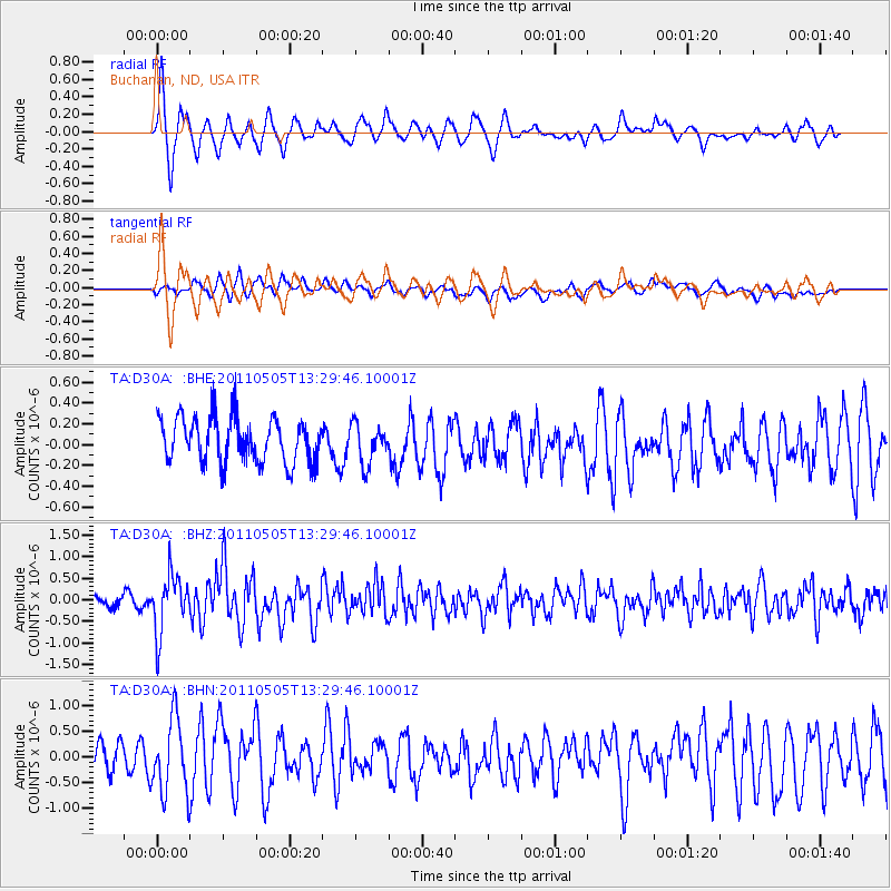
D30A Buchanan, ND, USA - Earthquake Result Viewer
*The percent match for this event was below the threshold and hence no stack was calculated.
| Earthquake location: |
Near Coast Of Guerrero, Mexico |
| Earthquake latitude/longitude: |
16.8/-98.6 |
| Earthquake time(UTC): |
2011/05/05 (125) 13:24:07 GMT |
| Earthquake Depth: |
24 km |
| Earthquake Magnitude: |
5.7 MW, 5.4 MS, 5.4 MB, 5.5 MW |
| Earthquake Catalog/Contributor: |
WHDF/NEIC |
|
| Network: |
TA USArray Transportable Network (new EarthScope stations) |
| Station: |
D30A Buchanan, ND, USA |
| Lat/Lon: |
47.11 N/98.76 W |
| Elevation: |
465 m |
|
| Distance: |
30.2 deg |
| Az: |
359.811 deg |
| Baz: |
179.734 deg |
| Ray Param: |
$rayparam |
*The percent match for this event was below the threshold and hence was not used in the summary stack. |
|
| Radial Match: |
75.24842 % |
| Radial Bump: |
390 |
| Transverse Match: |
57.0231 % |
| Transverse Bump: |
400 |
| SOD ConfigId: |
356183 |
| Insert Time: |
2011-10-06 08:27:03.989 +0000 |
| GWidth: |
2.5 |
| Max Bumps: |
400 |
| Tol: |
0.001 |
|
Signal To Noise
| Channel | StoN | STA | LTA |
| TA:D30A: :BHZ:20110505T13:29:46.10001Z | 6.6111064 | 6.612572E-7 | 1.0002218E-7 |
| TA:D30A: :BHN:20110505T13:29:46.10001Z | 2.351599 | 7.2336155E-7 | 3.0760413E-7 |
| TA:D30A: :BHE:20110505T13:29:46.10001Z | 0.90175253 | 1.9227856E-7 | 2.1322765E-7 |
| Arrivals |
| Ps | |
| PpPs | |
| PsPs/PpSs | |


