You are here: Home > Network List > TA - USArray Transportable Network (new EarthScope stations) Stations List
> Station 536A Bastrop, TX, USA > Earthquake Result Viewer
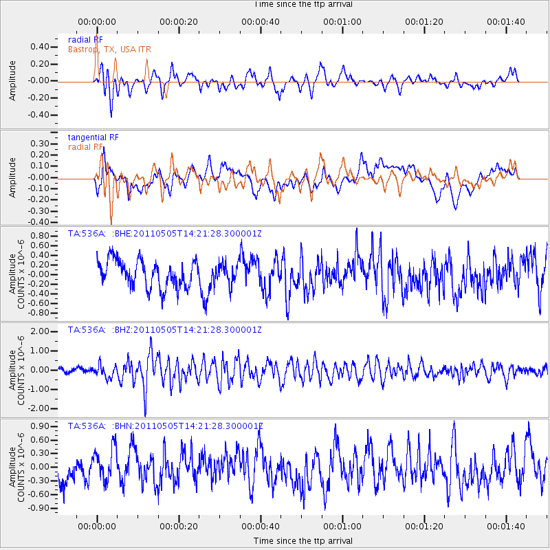
536A Bastrop, TX, USA - Earthquake Result Viewer
*The percent match for this event was below the threshold and hence no stack was calculated.
| Earthquake location: |
Alaska Peninsula |
| Earthquake latitude/longitude: |
55.1/-160.5 |
| Earthquake time(UTC): |
2011/05/05 (125) 14:13:01 GMT |
| Earthquake Depth: |
39 km |
| Earthquake Magnitude: |
5.9 MB, 5.3 MS, 5.7 MW, 5.7 MW |
| Earthquake Catalog/Contributor: |
WHDF/NEIC |
|
| Network: |
TA USArray Transportable Network (new EarthScope stations) |
| Station: |
536A Bastrop, TX, USA |
| Lat/Lon: |
30.08 N/97.07 W |
| Elevation: |
115 m |
|
| Distance: |
50.9 deg |
| Az: |
92.228 deg |
| Baz: |
318.499 deg |
| Ray Param: |
$rayparam |
*The percent match for this event was below the threshold and hence was not used in the summary stack. |
|
| Radial Match: |
71.628334 % |
| Radial Bump: |
400 |
| Transverse Match: |
50.956547 % |
| Transverse Bump: |
400 |
| SOD ConfigId: |
356183 |
| Insert Time: |
2011-10-06 10:11:15.697 +0000 |
| GWidth: |
2.5 |
| Max Bumps: |
400 |
| Tol: |
0.001 |
|
Signal To Noise
| Channel | StoN | STA | LTA |
| TA:536A: :BHZ:20110505T14:21:28.300001Z | 2.0081084 | 3.1441687E-7 | 1.5657365E-7 |
| TA:536A: :BHN:20110505T14:21:28.300001Z | 1.4845556 | 3.6566112E-7 | 2.4631015E-7 |
| TA:536A: :BHE:20110505T14:21:28.300001Z | 0.76140416 | 2.1110436E-7 | 2.7725667E-7 |
| Arrivals |
| Ps | |
| PpPs | |
| PsPs/PpSs | |


