KBK KN.KBK - Earthquake Result Viewer
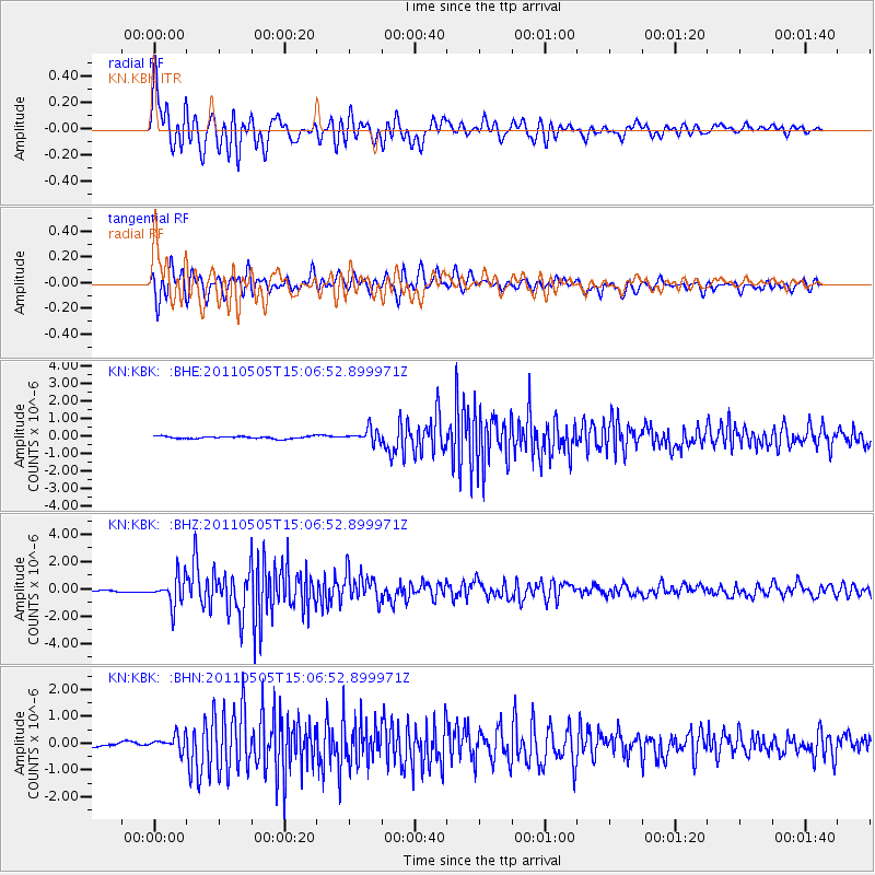
Earthquake location: Off East Coast Of Honshu, Japan
Earthquake latitude/longitude: 38.2/144.0
Earthquake time(UTC): 2011/05/05 (125) 14:58:18 GMT
Earthquake Depth: 11 km
Earthquake Magnitude: 6.2 MB, 5.7 MS, 6.1 MW, 6.1 MW
Earthquake Catalog/Contributor: WHDF/NEIC
Network: KN Kyrgyz Seismic Telemetry Network
Station: KBK KN.KBK
Lat/Lon: 42.66 N/74.95 E
Elevation: 1760 m
Distance: 51.5 deg
Az: 298.237 deg
Baz: 70.272 deg
Ray Param: 0.067399055
Estimated Moho Depth: 26.0 km
Estimated Crust Vp/Vs: 2.10
Assumed Crust Vp: 6.306 km/s
Estimated Crust Vs: 3.006 km/s
Estimated Crust Poisson's Ratio: 0.35
Radial Match: 92.73838 %
Radial Bump: 400
Transverse Match: 86.48178 %
Transverse Bump: 400
SOD ConfigId: 356183
Insert Time: 2011-10-06 13:20:47.636 +0000
GWidth: 2.5
Max Bumps: 400
Tol: 0.001

Signal To Noise

ChannelStoNSTALTA
KN:KBK: :BHZ:20110505T15:06:52.899971Z11.2139471.0429762E-69.300705E-8
KN:KBK: :BHN:20110505T15:06:52.899971Z4.99141932.8198318E-75.6493583E-8
KN:KBK: :BHE:20110505T15:06:52.899971Z5.93204833.795463E-76.3982334E-8
Arrivals
Ps4.7 SECOND
PpPs12 SECOND
PsPs/PpSs17 SECOND