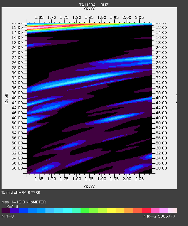
H28A Mission Ridge, SD, USA - Earthquake Result Viewer
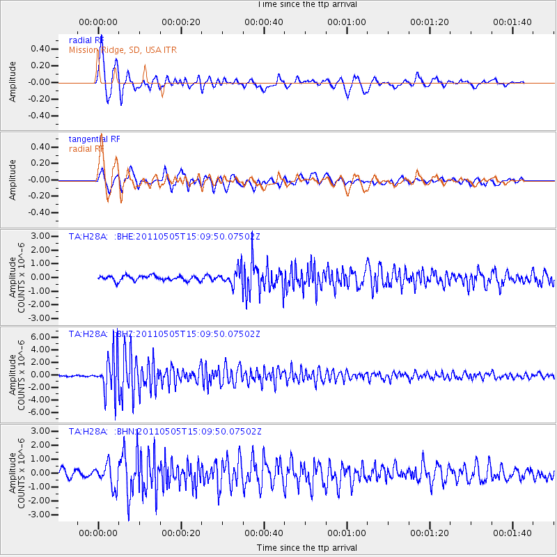
Earthquake location: Off East Coast Of Honshu, Japan
Earthquake latitude/longitude: 38.2/144.0
Earthquake time(UTC): 2011/05/05 (125) 14:58:18 GMT
Earthquake Depth: 11 km
Earthquake Magnitude: 6.2 MB, 5.7 MS, 6.1 MW, 6.1 MW
Earthquake Catalog/Contributor: WHDF/NEIC
Network: TA USArray Transportable Network (new EarthScope stations)
Station: H28A Mission Ridge, SD, USA
Lat/Lon: 44.68 N/101.02 W
Elevation: 642 m
Distance: 78.8 deg
Az: 41.256 deg
Baz: 313.24 deg
Ray Param: 0.049386427
Estimated Moho Depth: 12.0 km
Estimated Crust Vp/Vs: 1.60
Assumed Crust Vp: 6.53 km/s
Estimated Crust Vs: 4.082 km/s
Estimated Crust Poisson's Ratio: 0.18
Radial Match: 86.92739 %
Radial Bump: 400
Transverse Match: 88.11104 %
Transverse Bump: 400
SOD ConfigId: 356183
Insert Time: 2011-10-06 13:54:32.715 +0000
GWidth: 2.5
Max Bumps: 400
Tol: 0.001

Signal To Noise

ChannelStoNSTALTA
TA:H28A: :BHZ:20110505T15:09:50.07502Z25.7290923.0813485E-61.1976127E-7
TA:H28A: :BHN:20110505T15:09:50.07502Z3.2597888.4374716E-72.5883497E-7
TA:H28A: :BHE:20110505T15:09:50.07502Z3.34454856.096083E-71.8226925E-7
Arrivals
Ps1.1 SECOND
PpPs4.6 SECOND
PsPs/PpSs5.8 SECOND