I28A Midland, SD, USA - Earthquake Result Viewer
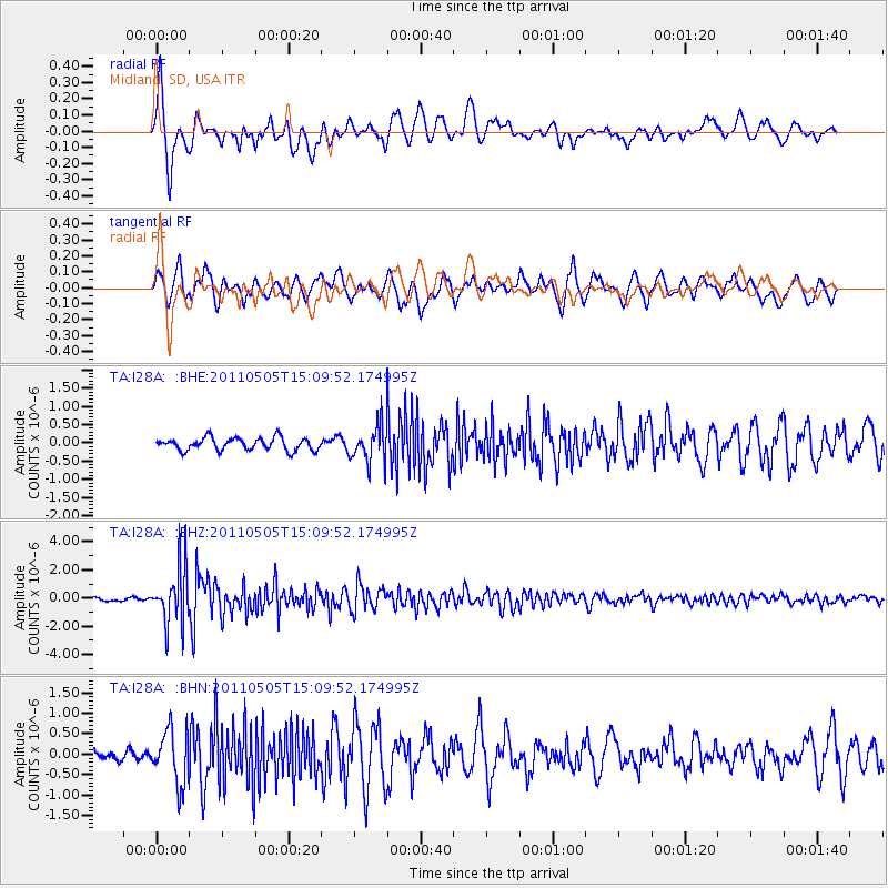
Earthquake location: Off East Coast Of Honshu, Japan
Earthquake latitude/longitude: 38.2/144.0
Earthquake time(UTC): 2011/05/05 (125) 14:58:18 GMT
Earthquake Depth: 11 km
Earthquake Magnitude: 6.2 MB, 5.7 MS, 6.1 MW, 6.1 MW
Earthquake Catalog/Contributor: WHDF/NEIC
Network: TA USArray Transportable Network (new EarthScope stations)
Station: I28A Midland, SD, USA
Lat/Lon: 44.00 N/101.17 W
Elevation: 655 m
Distance: 79.2 deg
Az: 41.832 deg
Baz: 313.246 deg
Ray Param: 0.049124565
Estimated Moho Depth: 37.75 km
Estimated Crust Vp/Vs: 2.05
Assumed Crust Vp: 6.483 km/s
Estimated Crust Vs: 3.166 km/s
Estimated Crust Poisson's Ratio: 0.34
Radial Match: 85.69922 %
Radial Bump: 400
Transverse Match: 86.81366 %
Transverse Bump: 400
SOD ConfigId: 356183
Insert Time: 2011-10-06 13:54:32.514 +0000
GWidth: 2.5
Max Bumps: 400
Tol: 0.001

Signal To Noise

ChannelStoNSTALTA
TA:I28A: :BHZ:20110505T15:09:52.174995Z15.299192.0108046E-61.314321E-7
TA:I28A: :BHN:20110505T15:09:52.174995Z2.9036666.542319E-72.2531236E-7
TA:I28A: :BHE:20110505T15:09:52.174995Z2.91652945.0082406E-71.7171918E-7
Arrivals
Ps6.3 SECOND
PpPs17 SECOND
PsPs/PpSs24 SECOND