H26A Fairpoint, SD, USA - Earthquake Result Viewer
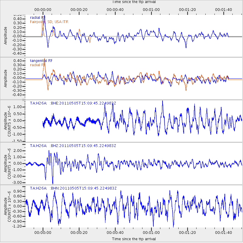
Earthquake location: Off East Coast Of Honshu, Japan
Earthquake latitude/longitude: 38.2/144.0
Earthquake time(UTC): 2011/05/05 (125) 14:58:18 GMT
Earthquake Depth: 11 km
Earthquake Magnitude: 6.2 MB, 5.7 MS, 6.1 MW, 6.1 MW
Earthquake Catalog/Contributor: WHDF/NEIC
Network: TA USArray Transportable Network (new EarthScope stations)
Station: H26A Fairpoint, SD, USA
Lat/Lon: 44.62 N/102.77 W
Elevation: 879 m
Distance: 77.9 deg
Az: 42.167 deg
Baz: 312.195 deg
Ray Param: 0.049984694
Estimated Moho Depth: 31.75 km
Estimated Crust Vp/Vs: 2.10
Assumed Crust Vp: 6.242 km/s
Estimated Crust Vs: 2.976 km/s
Estimated Crust Poisson's Ratio: 0.35
Radial Match: 81.56686 %
Radial Bump: 400
Transverse Match: 72.95153 %
Transverse Bump: 400
SOD ConfigId: 356183
Insert Time: 2011-10-06 13:57:49.314 +0000
GWidth: 2.5
Max Bumps: 400
Tol: 0.001

Signal To Noise

ChannelStoNSTALTA
TA:H26A: :BHZ:20110505T15:09:45.224983Z9.4912831.0671276E-61.1243238E-7
TA:H26A: :BHN:20110505T15:09:45.224983Z1.29646783.9151354E-73.0198478E-7
TA:H26A: :BHE:20110505T15:09:45.224983Z1.99296964.3145516E-72.1648859E-7
Arrivals
Ps5.7 SECOND
PpPs15 SECOND
PsPs/PpSs21 SECOND