
D30A Buchanan, ND, USA - Earthquake Result Viewer
| ||||||||||||||||||
| ||||||||||||||||||
| ||||||||||||||||||
|
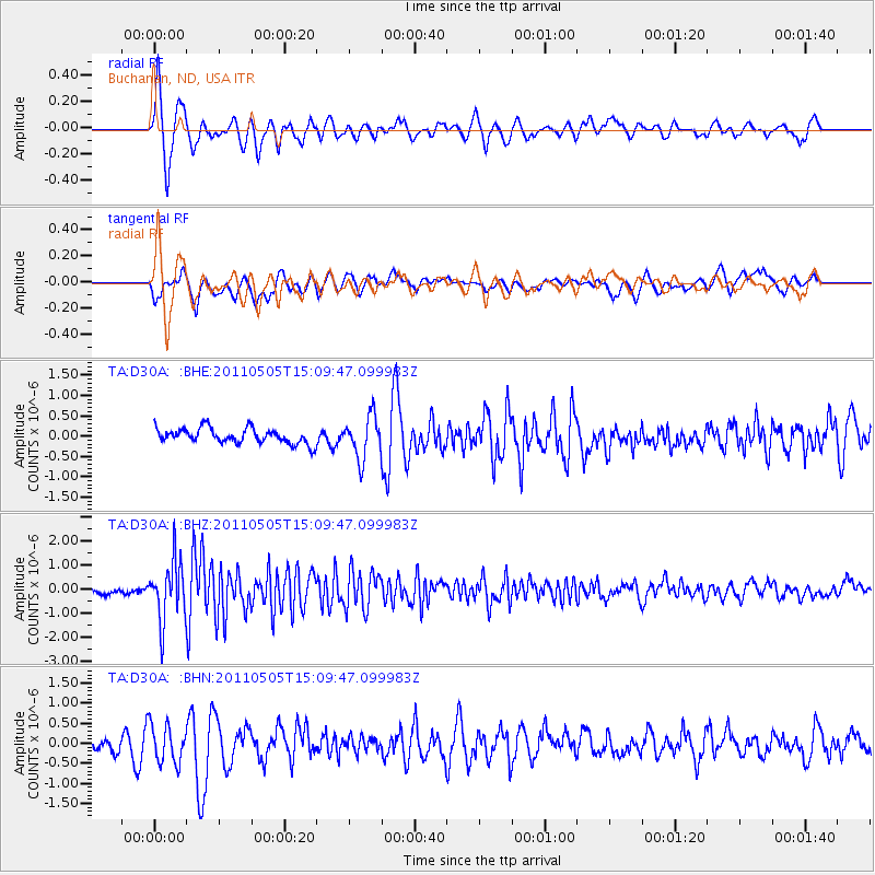
Signal To Noise
| Channel | StoN | STA | LTA |
| TA:D30A: :BHZ:20110505T15:09:47.099983Z | 11.255428 | 1.2258245E-6 | 1.08909624E-7 |
| TA:D30A: :BHN:20110505T15:09:47.099983Z | 2.5229027 | 4.8541233E-7 | 1.9240231E-7 |
| TA:D30A: :BHE:20110505T15:09:47.099983Z | 2.781819 | 5.191317E-7 | 1.866159E-7 |
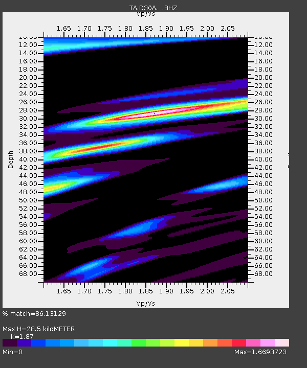
| Arrivals | |
| Ps | 3.9 SECOND |
| PpPs | 12 SECOND |
| PsPs/PpSs | 16 SECOND |

