G30A Faulkton, SD, USA - Earthquake Result Viewer
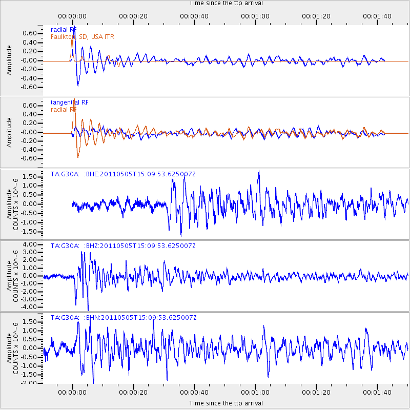
Earthquake location: Off East Coast Of Honshu, Japan
Earthquake latitude/longitude: 38.2/144.0
Earthquake time(UTC): 2011/05/05 (125) 14:58:18 GMT
Earthquake Depth: 11 km
Earthquake Magnitude: 6.2 MB, 5.7 MS, 6.1 MW, 6.1 MW
Earthquake Catalog/Contributor: WHDF/NEIC
Network: TA USArray Transportable Network (new EarthScope stations)
Station: G30A Faulkton, SD, USA
Lat/Lon: 45.13 N/99.14 W
Elevation: 496 m
Distance: 79.5 deg
Az: 39.983 deg
Baz: 314.319 deg
Ray Param: 0.048944023
Estimated Moho Depth: 10.0 km
Estimated Crust Vp/Vs: 1.60
Assumed Crust Vp: 6.53 km/s
Estimated Crust Vs: 4.082 km/s
Estimated Crust Poisson's Ratio: 0.18
Radial Match: 92.411064 %
Radial Bump: 400
Transverse Match: 63.872868 %
Transverse Bump: 400
SOD ConfigId: 356183
Insert Time: 2011-10-06 14:10:11.383 +0000
GWidth: 2.5
Max Bumps: 400
Tol: 0.001

Signal To Noise

ChannelStoNSTALTA
TA:G30A: :BHZ:20110505T15:09:53.625007Z10.095911.5215911E-61.5071362E-7
TA:G30A: :BHN:20110505T15:09:53.625007Z3.49118268.252621E-72.3638468E-7
TA:G30A: :BHE:20110505T15:09:53.625007Z3.85587627.1145416E-71.8451168E-7
Arrivals
Ps0.9 SECOND
PpPs3.9 SECOND
PsPs/PpSs4.8 SECOND