You are here: Home > Network List > TA - USArray Transportable Network (new EarthScope stations) Stations List
> Station G03D McMinnville, OR, USA > Earthquake Result Viewer
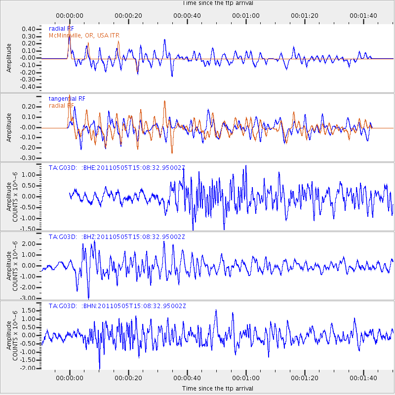
G03D McMinnville, OR, USA - Earthquake Result Viewer
*The percent match for this event was below the threshold and hence no stack was calculated.
| Earthquake location: |
Off East Coast Of Honshu, Japan |
| Earthquake latitude/longitude: |
38.2/144.0 |
| Earthquake time(UTC): |
2011/05/05 (125) 14:58:18 GMT |
| Earthquake Depth: |
11 km |
| Earthquake Magnitude: |
6.2 MB, 5.7 MS, 6.1 MW, 6.1 MW |
| Earthquake Catalog/Contributor: |
WHDF/NEIC |
|
| Network: |
TA USArray Transportable Network (new EarthScope stations) |
| Station: |
G03D McMinnville, OR, USA |
| Lat/Lon: |
45.21 N/123.26 W |
| Elevation: |
222 m |
|
| Distance: |
65.9 deg |
| Az: |
50.694 deg |
| Baz: |
300.368 deg |
| Ray Param: |
$rayparam |
*The percent match for this event was below the threshold and hence was not used in the summary stack. |
|
| Radial Match: |
72.4292 % |
| Radial Bump: |
400 |
| Transverse Match: |
68.07652 % |
| Transverse Bump: |
400 |
| SOD ConfigId: |
356183 |
| Insert Time: |
2011-10-06 14:20:00.243 +0000 |
| GWidth: |
2.5 |
| Max Bumps: |
400 |
| Tol: |
0.001 |
|
Signal To Noise
| Channel | StoN | STA | LTA |
| TA:G03D: :BHZ:20110505T15:08:32.95002Z | 3.8032877 | 9.4917726E-7 | 2.4956756E-7 |
| TA:G03D: :BHN:20110505T15:08:32.95002Z | 0.86688375 | 1.7958497E-7 | 2.0716153E-7 |
| TA:G03D: :BHE:20110505T15:08:32.95002Z | 1.9661945 | 3.796829E-7 | 1.9310546E-7 |
| Arrivals |
| Ps | |
| PpPs | |
| PsPs/PpSs | |


