M35A Neola, IA, USA - Earthquake Result Viewer
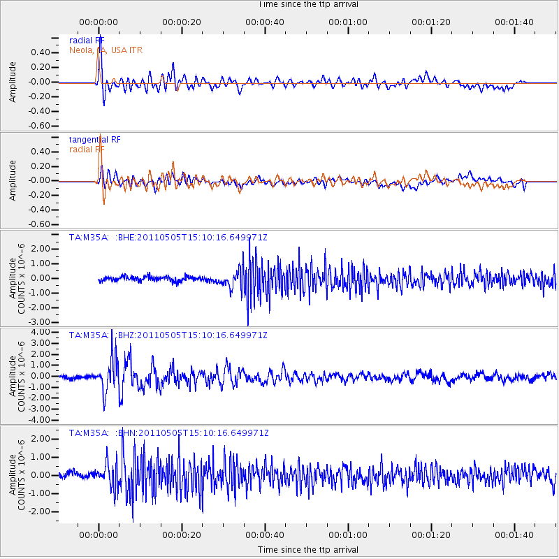
Earthquake location: Off East Coast Of Honshu, Japan
Earthquake latitude/longitude: 38.2/144.0
Earthquake time(UTC): 2011/05/05 (125) 14:58:18 GMT
Earthquake Depth: 11 km
Earthquake Magnitude: 6.2 MB, 5.7 MS, 6.1 MW, 6.1 MW
Earthquake Catalog/Contributor: WHDF/NEIC
Network: TA USArray Transportable Network (new EarthScope stations)
Station: M35A Neola, IA, USA
Lat/Lon: 41.47 N/95.69 W
Elevation: 363 m
Distance: 83.8 deg
Az: 40.755 deg
Baz: 316.791 deg
Ray Param: 0.045902357
Estimated Moho Depth: 30.25 km
Estimated Crust Vp/Vs: 1.76
Assumed Crust Vp: 6.498 km/s
Estimated Crust Vs: 3.697 km/s
Estimated Crust Poisson's Ratio: 0.26
Radial Match: 82.404655 %
Radial Bump: 400
Transverse Match: 65.78585 %
Transverse Bump: 400
SOD ConfigId: 356183
Insert Time: 2011-10-06 14:57:38.152 +0000
GWidth: 2.5
Max Bumps: 400
Tol: 0.001

Signal To Noise

ChannelStoNSTALTA
TA:M35A: :BHZ:20110505T15:10:16.649971Z10.9967261.5016143E-61.3655104E-7
TA:M35A: :BHN:20110505T15:10:16.649971Z3.6436736.670595E-71.8307338E-7
TA:M35A: :BHE:20110505T15:10:16.649971Z4.2574256.3828816E-71.4992354E-7
Arrivals
Ps3.6 SECOND
PpPs13 SECOND
PsPs/PpSs16 SECOND